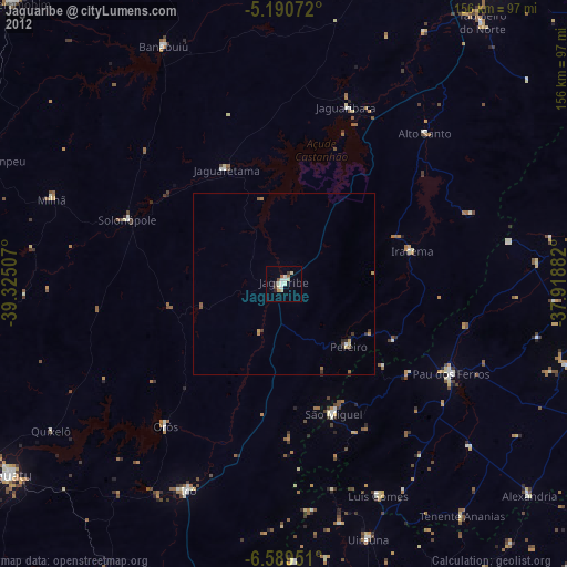
Jaguaribe night lights from space
Night Light of Jaguaribe (Ceará) from space (Brazil) Src. Average luminocity for 10x10km area is 16.3884% and for 50x50km: 1.2321%.
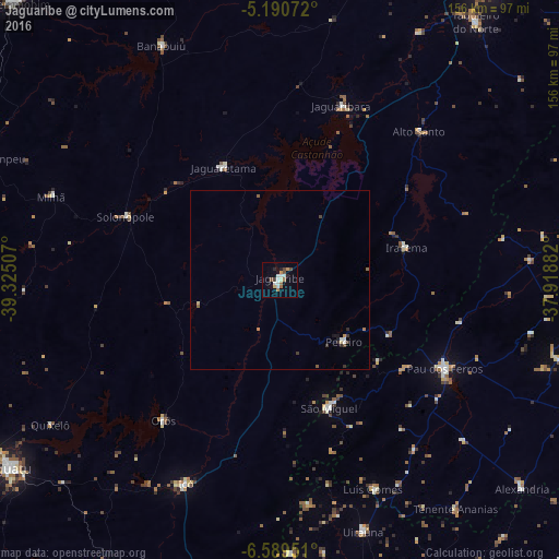
Analysis of Jaguaribe night lights 2016
Square area 10x10 km:
 3.1%
3.1%90-99
2.69%80-89
1.65%70-79
1.65%60-69
2.48%50-59
1.86%40-49
2.69%30-39
0.41%20-29
2.48%10-19
0.83%0-9
80.17%Square area 50x50 km:
0.15%90-99
0.2%80-89
0.14%70-79
0.1%60-69
0.21%50-59
0.18%40-49
0.18%30-39
0.18%20-29
0.21%10-19
0.14%0-9
98.32%Clear (daylight) street map image can be seen on geolist.org.
Map coordinates:
5° 11' 26.6" South, 39° 19' 30.3" West
5° 53' 26" South, 38° 37' 19" West
6° 35' 22.2" South, 37° 55' 7.8" West
Some cities around Jaguaribe sort by population:
• Iguatu
91.2 km =56.7 mi,  235°
235°
• Icó
62.7 km =39 mi,  205°
205°
• Senador Pompeu
89.5 km =55.6 mi,  292°
292°
• Orós
50.9 km =31.6 mi,  219°
219°
• Alexandria
88.6 km =55.1 mi,  130°
130°
• Umarizal
90 km =55.9 mi,  97°
97°
• Serra Branca
81.5 km =50.6 mi,  151°
151°
• Uiraúna
73.6 km =45.7 mi,  161°
161°
3397675 (p: 23,065)
Sources (retrieved 2019-11-25):
» Earth at Night: Flat Maps 2012, 2016