Ceres night lights from space
Night Light of Ceres (Goiás) from space (Brazil) Src. Average luminocity for 10x10km area is 21.7727% and for 50x50km: 2.3318%.
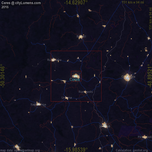
Analysis of Ceres night lights 2016
Square area 10x10 km:
 1.03%
1.03%90-99
1.45%80-89
4.13%70-79
8.26%60-69
3.1%50-59
0.62%40-49
2.89%30-39
2.48%20-29
1.03%10-19
12.19%0-9
62.81%Square area 50x50 km:
0.11%90-99
0.12%80-89
0.24%70-79
1.03%60-69
0.27%50-59
0.15%40-49
0.57%30-39
0.18%20-29
0.24%10-19
0.69%0-9
96.4%Clear (daylight) street map image can be seen on geolist.org.
Map coordinates:
14° 37' 44.7" South, 50° 18' 5.3" West
15° 18' 30" South, 49° 35' 54" West
15° 59' 7.4" South, 48° 53' 42.8" West
Some cities around Ceres sort by population:
• Goianésia
51.6 km =32.1 mi,  91°
91°
• Jaraguá
57.3 km =35.6 mi,  150°
150°
• Itapuranga
47 km =29.2 mi,  233°
233°
• Rubiataba
27.2 km =16.9 mi,  306°
306°
• Itapaci
40.1 km =24.9 mi,  7°
7°
• Uruana
23.5 km =14.6 mi,  202°
202°
• Rialma
1.7 km =1.1 mi,  116°
116°
• Carmo do Rio Verde
12.7 km =7.9 mi,  246°
246°
3466436 (p: 18,759)
Sources (retrieved 2019-11-25):
» Earth at Night: Flat Maps 2012, 2016