Carapicuíba night lights from space
Night Light of Carapicuíba (São Paulo) from space (Brazil) Src. Average luminocity for 10x10km area is 97.8532% and for 50x50km: 67.658%.
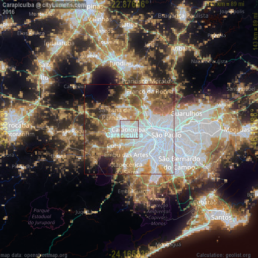
Analysis of Carapicuíba night lights 2016
Square area 10x10 km:
 68.06%
90-99
22.42%80-89
7.54%70-79
1.98%60-69
0%50-59
0%40-49
0%30-39
0%20-29
0%10-19
0%0-9
0%Square area 50x50 km:
28.61%90-99
9.26%80-89
5.11%70-79
9.11%60-69
9.83%50-59
10.07%40-49
7.69%30-39
4.39%20-29
5.21%10-19
4.45%0-9
6.27%Clear (daylight) street map image can be seen on geolist.org.
Map coordinates:
22° 52' 35.3" South, 47° 32' 17.3" West
23° 31' 21.8" South, 46° 50' 6" West
24° 9' 57" South, 46° 7' 54.8" West
Some cities around Carapicuíba sort by population:
• Osasco
4.5 km =2.8 mi,  103°
103°
• Barueri
4.4 km =2.7 mi,  287°
287°
• Embu
14.1 km =8.8 mi,  187°
187°
• Taboão da Serra
12.3 km =7.6 mi,  158°
158°
• Itapevi
10.5 km =6.5 mi,  253°
253°
• Cotia
12.5 km =7.8 mi,  223°
223°
• Jandira
6.9 km =4.3 mi,  265°
265°
• Santana de Parnaíba
12.1 km =7.5 mi,  315°
315°
3466998 (p: 361,112)
Sources (retrieved 2019-11-25):
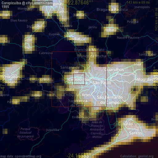
» NASA, Earths city lights 1995
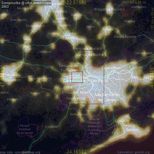
» NASA city lights 2003
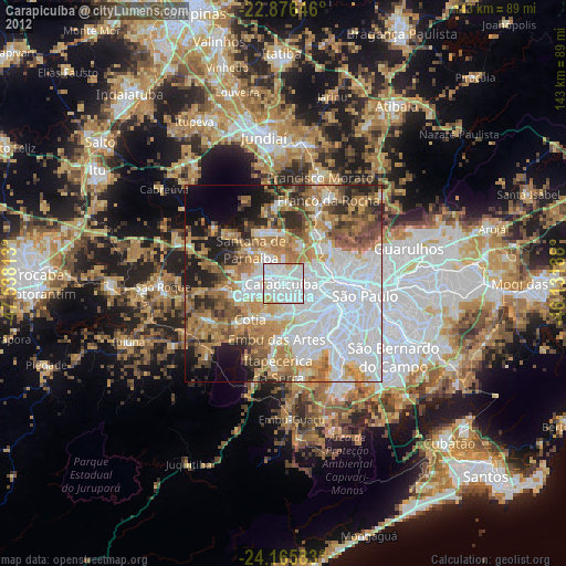
» Earth at Night: Flat Maps 2012, 2016