Embu night lights from space
Night Light of Embu (São Paulo) from space (Brazil) Src. Average luminocity for 10x10km area is 79.3512% and for 50x50km: 62.3805%.

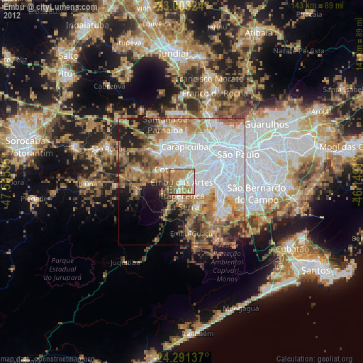
Analysis of Embu night lights 2016
Square area 10x10 km:
 16.47%
90-99
18.65%80-89
8.13%70-79
26.39%60-69
19.05%50-59
9.72%40-49
1.59%30-39
0%20-29
0%10-19
0%0-9
0%Square area 50x50 km:
26.19%90-99
8.33%80-89
4.89%70-79
9.02%60-69
9.77%50-59
8.4%40-49
6.32%30-39
4.23%20-29
5.39%10-19
3.88%0-9
13.58%Clear (daylight) street map image can be seen on geolist.org.
Map coordinates:
23° 0' 11.7" South, 47° 33' 19.3" West
23° 38' 56" South, 46° 51' 8" West
24° 17' 28.9" South, 46° 8' 56.8" West
Some cities around Embu sort by population:
• Osasco
14.3 km =8.9 mi,  25°
25°
• Carapicuíba
14.1 km =8.8 mi,  7°
7°
• Barueri
15.6 km =9.7 mi,  351°
351°
• Taboão da Serra
6.7 km =4.2 mi,  67°
67°
• Itapevi
13.9 km =8.6 mi,  323°
323°
• Cotia
8.5 km =5.3 mi,  306°
306°
• Itapecerica da Serra
7.6 km =4.7 mi,  177°
177°
• Jandira
14.4 km =8.9 mi,  339°
339°
3464305 (p: 221,733)
Sources (retrieved 2019-11-25):
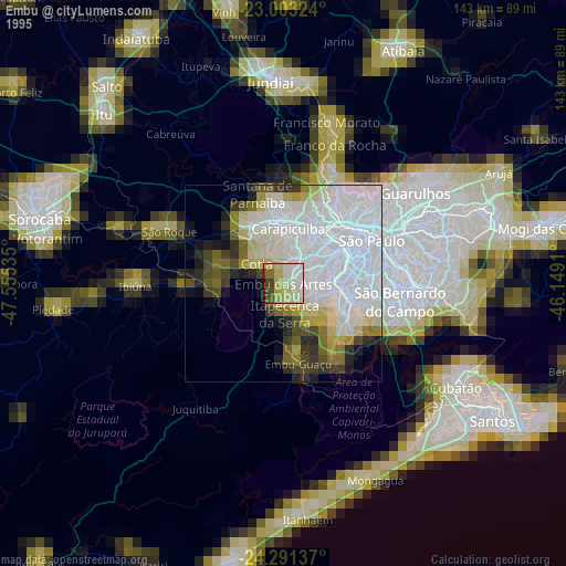
» NASA, Earths city lights 1995
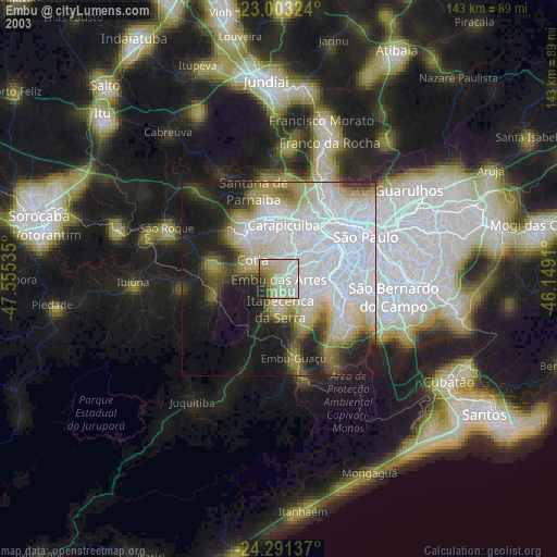
» NASA city lights 2003
» Earth at Night: Flat Maps 2012, 2016