Campos do Jordão night lights from space
Night Light of Campos do Jordão (São Paulo) from space (Brazil) Src. Average luminocity for 10x10km area is 35.6667% and for 50x50km: 7.1102%.
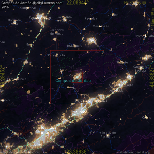
Analysis of Campos do Jordão night lights 2016
Square area 10x10 km:
 1.59%
1.59%90-99
4.17%80-89
7.14%70-79
5.16%60-69
6.75%50-59
10.71%40-49
4.56%30-39
3.17%20-29
4.17%10-19
33.93%0-9
18.65%Square area 50x50 km:
0.66%90-99
1.02%80-89
0.77%70-79
1.19%60-69
1.07%50-59
1.1%40-49
1.12%30-39
1.34%20-29
1.98%10-19
4.36%0-9
85.39%Clear (daylight) street map image can be seen on geolist.org.
Map coordinates:
22° 5' 22" South, 46° 17' 40.3" West
22° 44' 22" South, 45° 35' 29" West
23° 23' 10.9" South, 44° 53' 17.8" West
Some cities around Campos do Jordão sort by population:
• Taubaté
32.1 km =19.9 mi,  173°
173°
• Pindamonhangaba
24.4 km =15.2 mi,  147°
147°
• Guaratinguetá
41.8 km =26 mi,  101°
101°
• Itajubá
37.7 km =23.4 mi,  22°
22°
• Caçapava
41.9 km =26 mi,  196°
196°
• Aparecida
39 km =24.2 mi,  107°
107°
• Tremembé
24.7 km =15.3 mi, 169°
• Paraisópolis
28.3 km =17.6 mi,  316°
316°
3467684 (p: 53,319)
Sources (retrieved 2019-11-25):
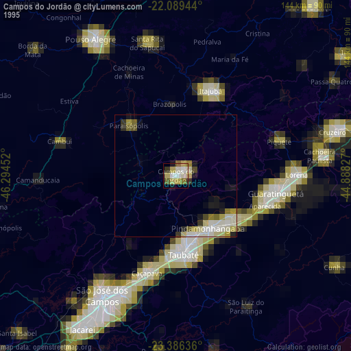
» NASA, Earths city lights 1995
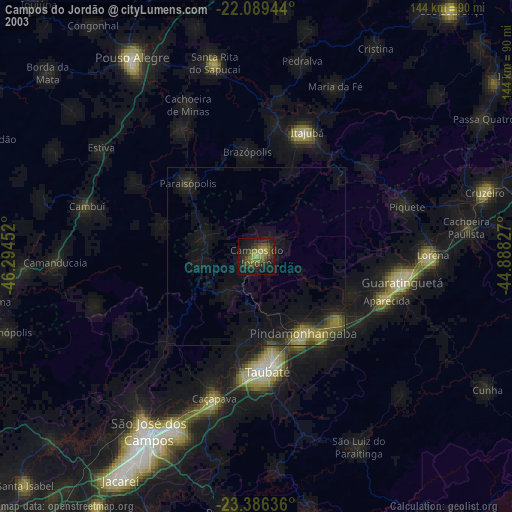
» NASA city lights 2003
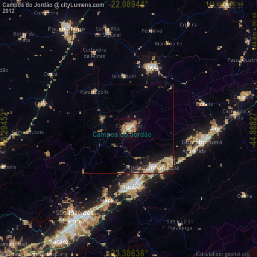
» Earth at Night: Flat Maps 2012, 2016