Ijuí night lights from space
Night Light of Ijuí (Rio Grande do Sul) from space (Brazil) Src. Average luminocity for 10x10km area is 34.996% and for 50x50km: 2.2818%.
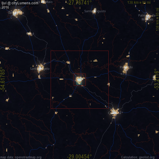
Analysis of Ijuí night lights 2016
Square area 10x10 km:
 1.59%
1.59%90-99
6.35%80-89
9.33%70-79
9.72%60-69
4.37%50-59
0.79%40-49
1.98%30-39
2.38%20-29
1.79%10-19
41.47%0-9
20.24%Square area 50x50 km:
0.07%90-99
0.25%80-89
0.52%70-79
0.54%60-69
0.35%50-59
0.18%40-49
0.17%30-39
0.4%20-29
0.18%10-19
1.76%0-9
95.58%Clear (daylight) street map image can be seen on geolist.org.
Map coordinates:
27° 46' 2.7" South, 54° 37' 4.3" West
28° 23' 16" South, 53° 54' 53" West
29° 0' 16.3" South, 53° 12' 41.8" West
Some cities around Ijuí sort by population:
• Cruz Alta
41.5 km =25.8 mi,  133°
133°
• Santo Ângelo
35.5 km =22.1 mi,  286°
286°
• Santa Rosa
79.9 km =49.6 mi,  315°
315°
• Panambi
41.8 km =26 mi,  75°
75°
• Três de Maio
75.4 km =46.9 mi,  334°
334°
• Tupanciretã
77.4 km =48.1 mi,  174°
174°
• Giruá
58.4 km =36.3 mi,  313°
313°
• Santo Augusto
61.2 km =38 mi,  12°
12°
3461444 (p: 71,202)
Sources (retrieved 2019-11-25):
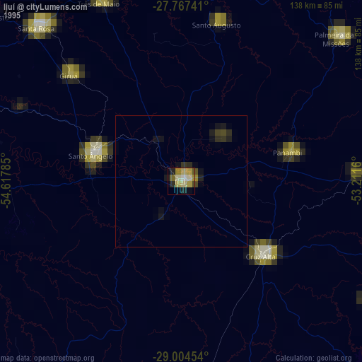
» NASA, Earths city lights 1995
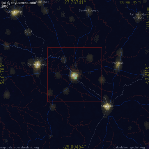
» NASA city lights 2003
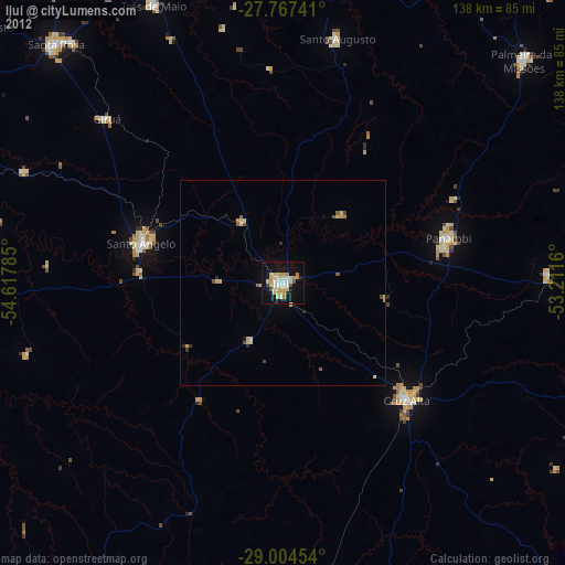
» Earth at Night: Flat Maps 2012, 2016