Santo Ângelo night lights from space
Night Light of Santo Ângelo (Rio Grande do Sul) from space (Brazil) Src. Average luminocity for 10x10km area is 33.6012% and for 50x50km: 1.9512%.
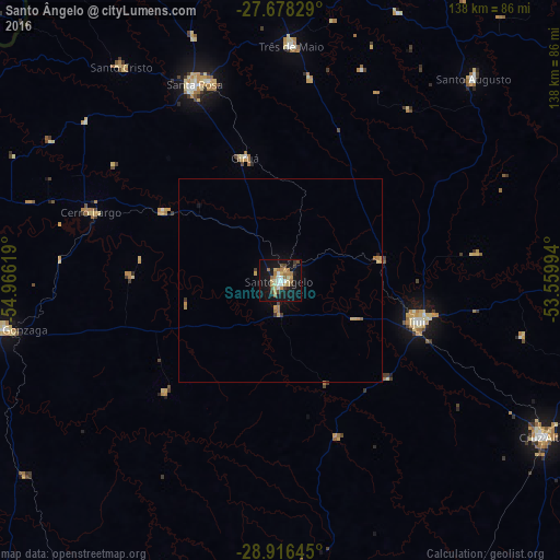
Analysis of Santo Ângelo night lights 2016
Square area 10x10 km:
 3.97%
3.97%90-99
4.96%80-89
4.76%70-79
5.56%60-69
7.94%50-59
2.38%40-49
3.77%30-39
3.97%20-29
1.39%10-19
42.66%0-9
18.65%Square area 50x50 km:
0.15%90-99
0.19%80-89
0.26%70-79
0.43%60-69
0.44%50-59
0.15%40-49
0.2%30-39
0.24%20-29
0.08%10-19
1.87%0-9
95.98%Clear (daylight) street map image can be seen on geolist.org.
Map coordinates:
27° 40' 41.8" South, 54° 57' 58.3" West
28° 17' 57" South, 54° 15' 47" West
28° 54' 59.2" South, 53° 33' 35.8" West
Some cities around Santo Ângelo sort by population:
• Ijuí
35.5 km =22.1 mi,  106°
106°
• Cruz Alta
74.8 km =46.5 mi,  120°
120°
• Santa Rosa
52.2 km =32.4 mi,  335°
335°
• São Luiz Gonzaga
69.3 km =43.1 mi,  259°
259°
• Panambi
74.5 km =46.3 mi,  89°
89°
• Três de Maio
58.5 km =36.4 mi,  2°
2°
• Giruá
31.3 km =19.4 mi, 344°
• Cerro Largo
49.5 km =30.8 mi,  289°
289°
3449696 (p: 64,606)
Sources (retrieved 2019-11-25):
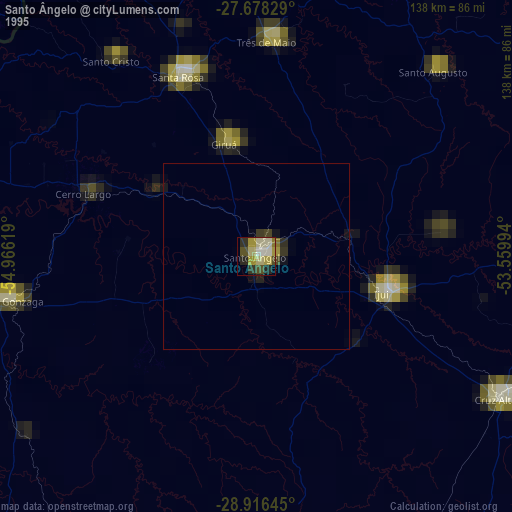
» NASA, Earths city lights 1995
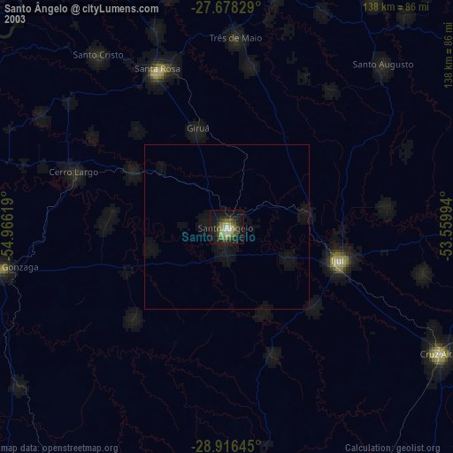
» NASA city lights 2003
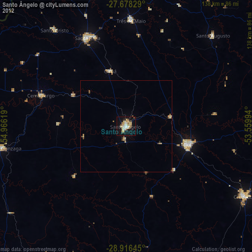
» Earth at Night: Flat Maps 2012, 2016