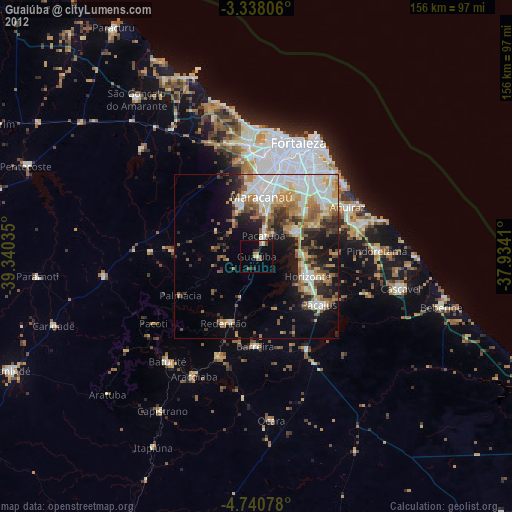
Guaiúba night lights from space
Night Light of Guaiúba (Ceará) from space (Brazil) Src. Average luminocity for 10x10km area is 12.7814% and for 50x50km: 29.3688%.
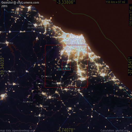
Analysis of Guaiúba night lights 2016
Square area 10x10 km:
 0%
0%90-99
0.87%80-89
0.22%70-79
1.52%60-69
3.9%50-59
3.9%40-49
2.16%30-39
1.3%20-29
1.52%10-19
13.85%0-9
70.78%Square area 50x50 km:
5.6%90-99
7.57%80-89
2.98%70-79
3.13%60-69
4.06%50-59
4.67%40-49
3.38%30-39
4.04%20-29
5.33%10-19
9.14%0-9
50.1%Clear (daylight) street map image can be seen on geolist.org.
Map coordinates:
3° 20' 17" South, 39° 20' 25.3" West
4° 2' 23" South, 38° 38' 14" West
4° 44' 26.8" South, 37° 56' 2.8" West
Some cities around Guaiúba sort by population:
• Maracanaú
18.2 km =11.3 mi,  4°
4°
• Aquiraz
31.3 km =19.4 mi,  60°
60°
• Pacatuba
6.5 km =4 mi,  16°
16°
• Horizonte
18.3 km =11.4 mi,  111°
111°
• Pacajus
24.5 km =15.2 mi,  126°
126°
• Eusébio
26.6 km =16.5 mi,  51°
51°
• Itaitinga
14.4 km =8.9 mi, 57°
• Redenção
23.1 km =14.4 mi,  206°
206°
3398614 (p: 21,820)
Sources (retrieved 2019-11-25):
» Earth at Night: Flat Maps 2012, 2016