Blumenau night lights from space
Night Light of Blumenau (Santa Catarina) from space (Brazil) Src. Average luminocity for 10x10km area is 63.754% and for 50x50km: 19.3439%.
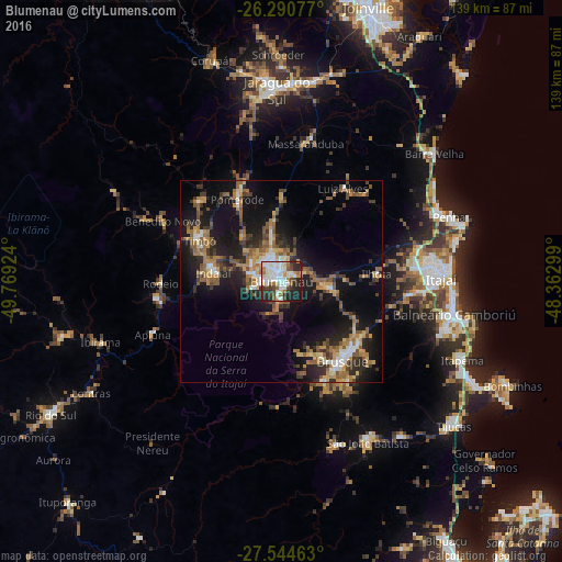
Analysis of Blumenau night lights 2016
Square area 10x10 km:
 17.06%
90-99
20.04%80-89
4.37%70-79
6.15%60-69
8.53%50-59
3.57%40-49
6.94%30-39
7.94%20-29
19.05%10-19
6.35%0-9
0%Square area 50x50 km:
1.62%90-99
2.55%80-89
1.65%70-79
2.71%60-69
3.78%50-59
4.17%40-49
2.69%30-39
3.5%20-29
5.75%10-19
14.91%0-9
56.65%Clear (daylight) street map image can be seen on geolist.org.
Map coordinates:
26° 17' 26.8" South, 49° 46' 9.3" West
26° 55' 10" South, 49° 3' 58" West
27° 32' 40.7" South, 48° 21' 46.8" West
Some cities around Blumenau sort by population:
• Itajaí
40.1 km =24.9 mi,  88°
88°
• Brusque
25 km =15.5 mi,  142°
142°
• Navegantes
40.9 km =25.4 mi, 86°
• Indaial
16.6 km =10.3 mi,  278°
278°
• Timbó
23 km =14.3 mi,  297°
297°
• Gaspar
10.7 km =6.6 mi,  97°
97°
• Pomerode
22.7 km =14.1 mi,  331°
331°
• Residencia Moacir PU5BHV
29.7 km =18.5 mi,  272°
272°
3469968 (p: 293,949)
Sources (retrieved 2019-11-25):
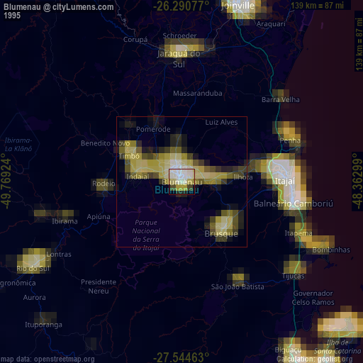
» NASA, Earths city lights 1995
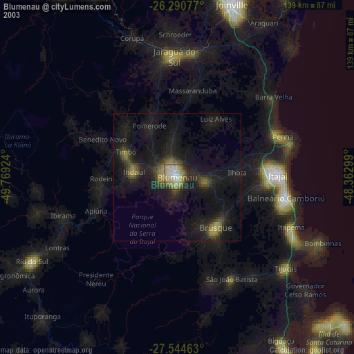
» NASA city lights 2003
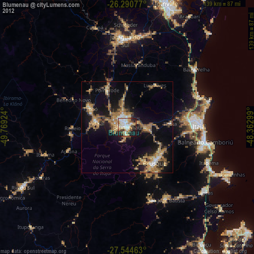
» Earth at Night: Flat Maps 2012, 2016