Flores night lights from space
Night Light of Flores (Pernambuco) from space (Brazil) Src. Average luminocity for 10x10km area is 2.9277% and for 50x50km: 1.9915%.
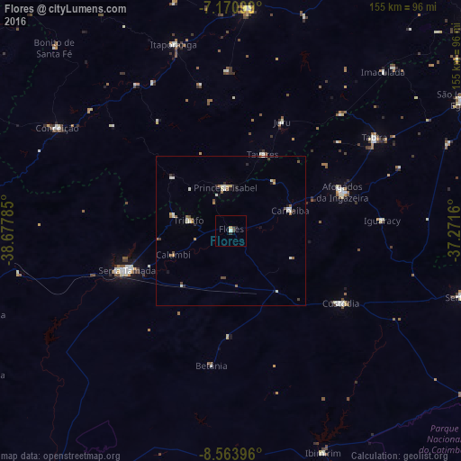
Analysis of Flores night lights 2016
Square area 10x10 km:
 0.41%
0.41%90-99
0.41%80-89
0.41%70-79
0.41%60-69
0%50-59
0.62%40-49
0.21%30-39
1.24%20-29
1.24%10-19
0%0-9
95.04%Square area 50x50 km:
0.13%90-99
0.56%80-89
0.23%70-79
0.17%60-69
0.25%50-59
0.31%40-49
0.29%30-39
0.22%20-29
0.24%10-19
0.28%0-9
97.33%Clear (daylight) street map image can be seen on geolist.org.
Map coordinates:
7° 10' 15.6" South, 38° 40' 40.3" West
7° 52' 5" South, 37° 58' 29" West
8° 33' 50.3" South, 37° 16' 17.8" West
Some cities around Flores sort by population:
• Serra Talhada
38.2 km =23.7 mi,  248°
248°
• Afogados da Ingazeira
39.2 km =24.4 mi,  70°
70°
• Custódia
43.9 km =27.3 mi,  123°
123°
• Tabira
57 km =35.4 mi,  57°
57°
• Itaporanga
65.6 km =40.8 mi,  342°
342°
• Princesa Isabel
14.8 km =9.2 mi,  352°
352°
• Ibimirim
81.1 km =50.4 mi,  157°
157°
• Piancó
74.7 km =46.4 mi,  3°
3°
3399539 (p: 11,692)
Sources (retrieved 2019-11-25):
» Earth at Night: Flat Maps 2012, 2016