Tabira night lights from space
Night Light of Tabira (Pernambuco) from space (Brazil) Src. Average luminocity for 10x10km area is 16.5758% and for 50x50km: 2.8084%.
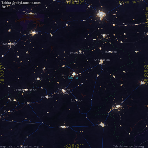
Analysis of Tabira night lights 2016
Square area 10x10 km:
 3.03%
3.03%90-99
2.16%80-89
0.87%70-79
1.95%60-69
2.81%50-59
1.3%40-49
2.81%30-39
2.38%20-29
3.03%10-19
2.81%0-9
76.84%Square area 50x50 km:
0.28%90-99
0.47%80-89
0.2%70-79
0.33%60-69
0.39%50-59
0.54%40-49
0.36%30-39
0.46%20-29
0.52%10-19
0.34%0-9
96.11%Clear (daylight) street map image can be seen on geolist.org.
Map coordinates:
6° 53' 36" South, 38° 14' 33.3" West
7° 35' 27" South, 37° 32' 22" West
8° 17' 14" South, 36° 50' 10.8" West
Some cities around Tabira sort by population:
• Afogados da Ingazeira
20.9 km =13 mi,  211°
211°
• São José do Egito
31.8 km =19.8 mi,  66°
66°
• Custódia
56.4 km =35 mi,  191°
191°
• Monteiro
56.9 km =35.4 mi,  125°
125°
• Princesa Isabel
52.6 km =32.7 mi,  252°
252°
• Flores
57 km =35.4 mi,  237°
237°
• Teixeira
51.6 km =32.1 mi,  37°
37°
• Desterro
59.4 km =36.9 mi,  55°
55°
3387082 (p: 16,926)
Sources (retrieved 2019-11-25):
» Earth at Night: Flat Maps 2012, 2016