Eunápolis night lights from space
Night Light of Eunápolis (Bahia) from space (Brazil) Src. Average luminocity for 10x10km area is 50.0434% and for 50x50km: 3.4538%.
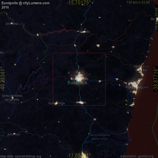

Analysis of Eunápolis night lights 2016
Square area 10x10 km:
 11.57%
90-99
17.36%80-89
4.96%70-79
2.48%60-69
1.24%50-59
8.06%40-49
5.58%30-39
2.48%20-29
10.12%10-19
31.4%0-9
4.75%Square area 50x50 km:
0.5%90-99
0.9%80-89
0.33%70-79
0.16%60-69
0.09%50-59
0.64%40-49
0.43%30-39
0.39%20-29
0.82%10-19
2.86%0-9
92.88%Clear (daylight) street map image can be seen on geolist.org.
Map coordinates:
15° 42' 6.3" South, 40° 17' 0.3" West
16° 22' 39" South, 39° 34' 49" West
17° 3' 3.3" South, 38° 52' 37.8" West
Some cities around Eunápolis sort by population:
• Porto Seguro
55.6 km =34.5 mi,  98°
98°
• Itamaraju
73.8 km =45.9 mi,  175°
175°
• Santa Cruz Cabrália
60.3 km =37.5 mi,  79°
79°
• Mascote
95.3 km =59.2 mi,  18°
18°
• Itarantim
95.2 km =59.2 mi,  326°
326°
• Belmonte
94.3 km =58.6 mi,  52°
52°
• Guaratinga
31.6 km =19.6 mi,  222°
222°
• Pau Brasil
101.8 km =63.3 mi,  355°
355°
3463690 (p: 114,275)
Sources (retrieved 2019-11-25):
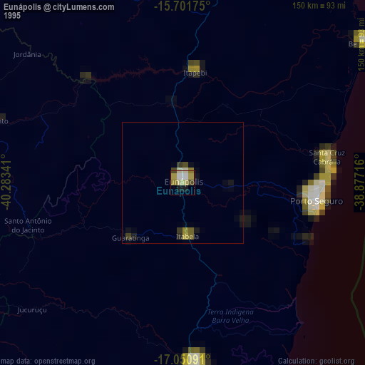
» NASA, Earths city lights 1995
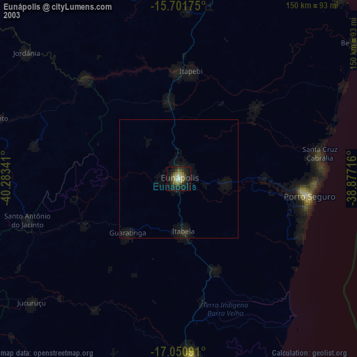
» NASA city lights 2003
» Earth at Night: Flat Maps 2012, 2016