Capivari night lights from space
Night Light of Capivari (São Paulo) from space (Brazil) Src. Average luminocity for 10x10km area is 40.2103% and for 50x50km: 20.448%.
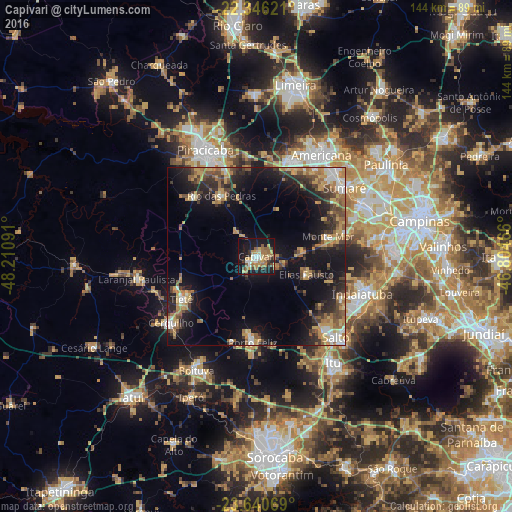
Analysis of Capivari night lights 2016
Square area 10x10 km:
 4.56%
4.56%90-99
3.97%80-89
6.94%70-79
6.94%60-69
10.32%50-59
6.94%40-49
4.37%30-39
3.57%20-29
5.36%10-19
40.48%0-9
6.55%Square area 50x50 km:
1.82%90-99
2%80-89
2.65%70-79
3.86%60-69
3.55%50-59
3.16%40-49
2.74%30-39
3.93%20-29
6.25%10-19
16.21%0-9
53.82%Clear (daylight) street map image can be seen on geolist.org.
Map coordinates:
22° 20' 46.4" South, 48° 12' 39.3" West
22° 59' 42" South, 47° 30' 28" West
23° 38' 26.5" South, 46° 48' 16.8" West
Some cities around Capivari sort by population:
• Sumaré
31.3 km =19.4 mi,  52°
52°
• Santa Bárbara d'Oeste
28.5 km =17.7 mi,  19°
19°
• Porto Feliz
24.5 km =15.2 mi,  183°
183°
• Monte Mor
20.4 km =12.7 mi,  74°
74°
• Cerquilho
30.6 km =19 mi,  231°
231°
• Tietê
24.3 km =15.1 mi,  240°
240°
• Rio das Pedras
19.6 km =12.2 mi,  329°
329°
• Elias Fausto
14.7 km =9.1 mi,  111°
111°
3467197 (p: 35,518)
Sources (retrieved 2019-11-25):
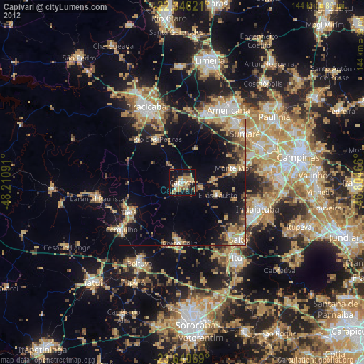
» Earth at Night: Flat Maps 2012, 2016