Sumaré night lights from space
Night Light of Sumaré (São Paulo) from space (Brazil) Src. Average luminocity for 10x10km area is 77.504% and for 50x50km: 49.7492%.
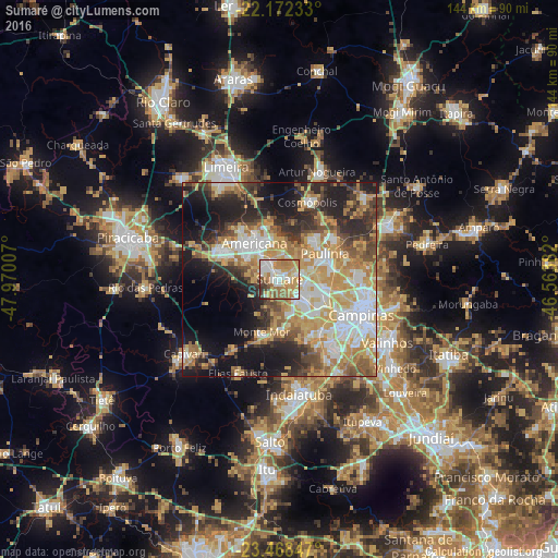
Analysis of Sumaré night lights 2016
Square area 10x10 km:
 18.06%
90-99
13.49%80-89
14.48%70-79
22.22%60-69
17.26%50-59
5.95%40-49
4.37%30-39
4.17%20-29
0%10-19
0%0-9
0%Square area 50x50 km:
8.74%90-99
9.04%80-89
7.96%70-79
10.91%60-69
7.87%50-59
5.27%40-49
5.64%30-39
6.06%20-29
10.15%10-19
14.17%0-9
14.19%Clear (daylight) street map image can be seen on geolist.org.
Map coordinates:
22° 10' 20.4" South, 47° 58' 12.3" West
22° 49' 19" South, 47° 16' 1" West
23° 28' 6.5" South, 46° 33' 49.8" West
Some cities around Sumaré sort by population:
• Campinas
23.1 km =14.4 mi,  113°
113°
• Hortolândia
6.3 km =3.9 mi,  130°
130°
• Americana
11.3 km =7 mi,  324°
324°
• Santa Bárbara d'Oeste
16.8 km =10.4 mi,  296°
296°
• Paulínia
13.4 km =8.3 mi,  59°
59°
• Nova Odessa
5.8 km =3.6 mi,  329°
329°
• Cosmópolis
20.9 km =13 mi,  20°
20°
• Monte Mor
14.7 km =9.1 mi,  199°
199°
3447259 (p: 227,977)
Sources (retrieved 2019-11-25):
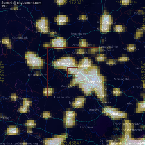
» NASA, Earths city lights 1995
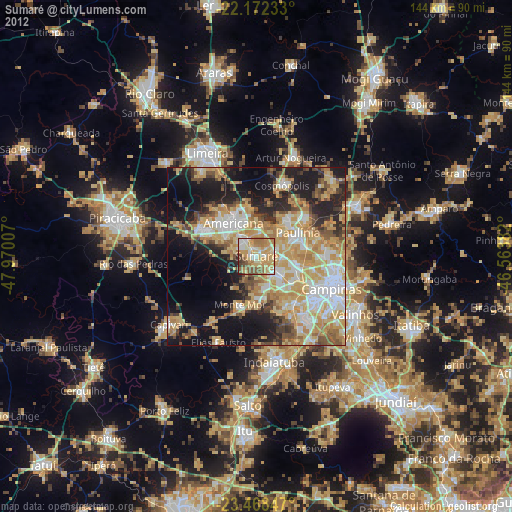
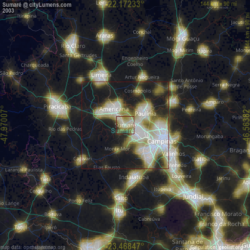
» NASA city lights 2003
» Earth at Night: Flat Maps 2012, 2016