Crato night lights from space
Night Light of Crato (Ceará) from space (Brazil) Src. Average luminocity for 10x10km area is 60.6017% and for 50x50km: 13.5967%.
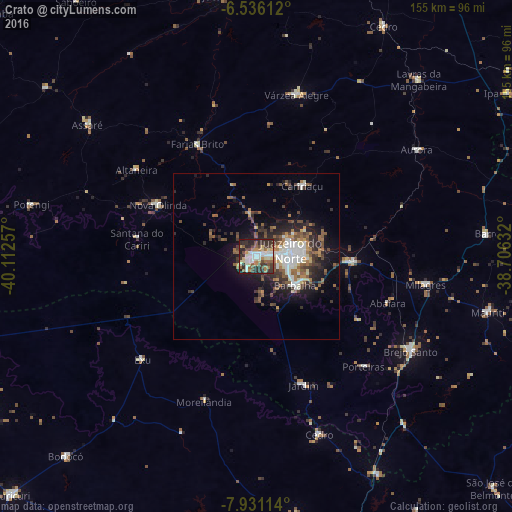
Analysis of Crato night lights 2016
Square area 10x10 km:
 11.04%
90-99
14.72%80-89
9.74%70-79
3.9%60-69
7.79%50-59
9.09%40-49
9.52%30-39
15.58%20-29
16.23%10-19
2.38%0-9
0%Square area 50x50 km:
2.12%90-99
2.37%80-89
1.11%70-79
0.89%60-69
2.19%50-59
2.42%40-49
2.32%30-39
2.85%20-29
4.15%10-19
6.79%0-9
72.79%Clear (daylight) street map image can be seen on geolist.org.
Map coordinates:
6° 32' 10" South, 40° 6' 45.3" West
7° 14' 3" South, 39° 24' 34" West
7° 55' 52.1" South, 38° 42' 22.8" West
Some cities around Crato sort by population:
• Juazeiro do Norte
10.6 km =6.6 mi,  77°
77°
• Barbalha
14.4 km =8.9 mi,  126°
126°
• Brejo Santo
54.8 km =34.1 mi,  121°
121°
• Missão Velha
29.4 km =18.3 mi,  93°
93°
• Caririaçu
25.5 km =15.8 mi,  33°
33°
• Milagres
51.9 km =32.2 mi,  99°
99°
• Farias Brito
37.9 km =23.5 mi,  332°
332°
• Exu
46.5 km =28.9 mi,  228°
228°
3401545 (p: 88,786)
Sources (retrieved 2019-11-25):
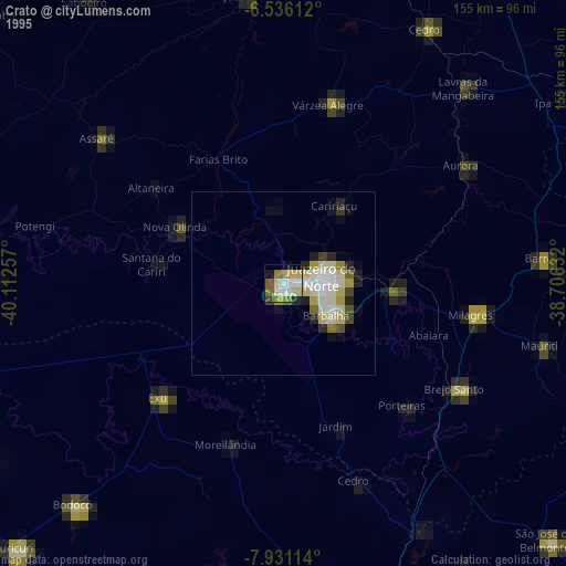
» NASA, Earths city lights 1995
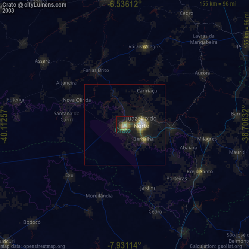
» NASA city lights 2003
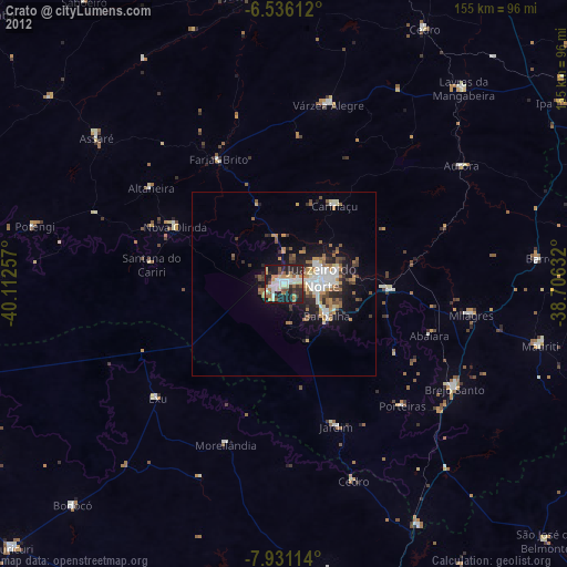
» Earth at Night: Flat Maps 2012, 2016