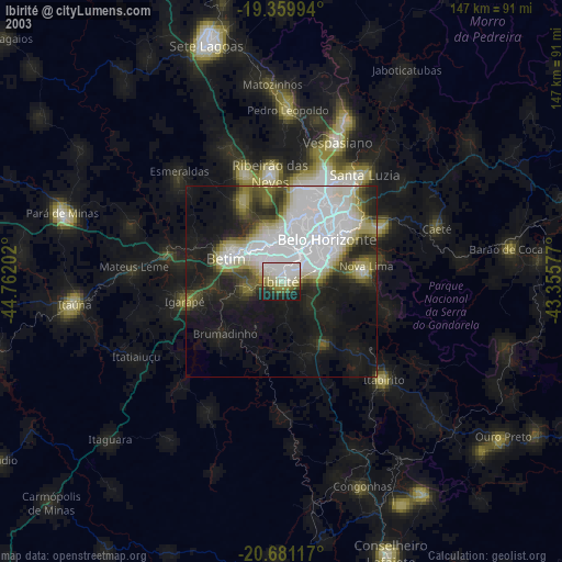
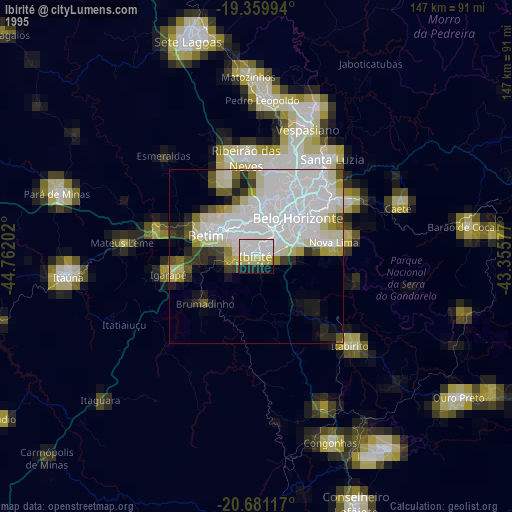
Ibirité night lights from space
Night Light of Ibirité (Minas Gerais) from space (Brazil) Src. Average luminocity for 10x10km area is 69.0476% and for 50x50km: 47.2831%.
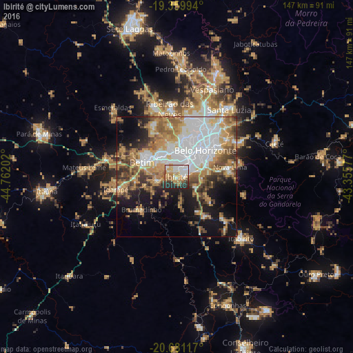

Analysis of Ibirité night lights 2016
Square area 10x10 km:
 17.66%
90-99
12.5%80-89
10.32%70-79
16.47%60-69
12.9%50-59
2.78%40-49
4.76%30-39
6.35%20-29
16.07%10-19
0.2%0-9
0%Square area 50x50 km:
14.2%90-99
6.37%80-89
3.7%70-79
10.02%60-69
7.71%50-59
5.12%40-49
6.24%30-39
5.02%20-29
5.65%10-19
13.16%0-9
22.79%Clear (daylight) street map image can be seen on geolist.org.
Map coordinates:
19° 21' 35.8" South, 44° 45' 43.3" West
20° 1' 19" South, 44° 3' 32" West
20° 40' 52.2" South, 43° 21' 20.8" West
Some cities around Ibirité sort by population:
• Belo Horizonte
16.9 km =10.5 mi,  48°
48°
• Contagem
10.1 km =6.3 mi,  3°
3°
• Betim
15.8 km =9.8 mi,  292°
292°
• Nova Lima
22.5 km =14 mi,  79°
79°
• Brumadinho
20 km =12.4 mi,  227°
227°
• Igarapé
25.9 km =16.1 mi,  258°
258°
• Sarzedo
9.1 km =5.7 mi, 260°
• São Joaquim de Bicas
22.7 km =14.1 mi, 262°
3461563 (p: 141,374)
Sources (retrieved 2019-11-25):
» NASA, Earths city lights 1995
» NASA city lights 2003
» Earth at Night: Flat Maps 2012, 2016