Catalão night lights from space
Night Light of Catalão (Goiás) from space (Brazil) Src. Average luminocity for 10x10km area is 60.7706% and for 50x50km: 4.6939%.
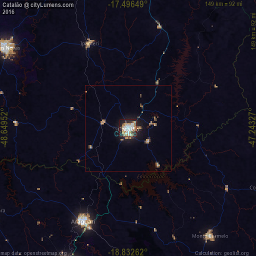

Analysis of Catalão night lights 2016
Square area 10x10 km:
 15.8%
15.8%90-99
15.15%80-89
3.03%70-79
10.82%60-69
13.2%50-59
0.22%40-49
7.58%30-39
4.55%20-29
14.07%10-19
15.37%0-9
0.22%Square area 50x50 km:
0.62%90-99
0.66%80-89
0.15%70-79
1.01%60-69
1.08%50-59
0.1%40-49
0.83%30-39
0.52%20-29
0.96%10-19
3.52%0-9
90.56%Clear (daylight) street map image can be seen on geolist.org.
Map coordinates:
17° 29' 47.4" South, 48° 38' 58.3" West
18° 9' 57" South, 47° 56' 47" West
18° 49' 57.4" South, 47° 14' 35.8" West
Some cities around Catalão sort by population:
• Uberlândia
90.7 km =56.4 mi,  202°
202°
• Araguari
59.2 km =36.8 mi,  205°
205°
• Caldas Novas
86 km =53.4 mi,  303°
303°
• Monte Carmelo
78.1 km =48.5 mi,  142°
142°
• Pires do Rio
102.6 km =63.8 mi,  339°
339°
• Tupaciguara
93 km =57.8 mi,  239°
239°
• Coromandel
85.9 km =53.4 mi,  113°
113°
• Ipameri
54.3 km =33.7 mi, 335°
3466696 (p: 63,544)
Sources (retrieved 2019-11-25):
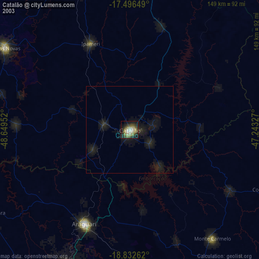
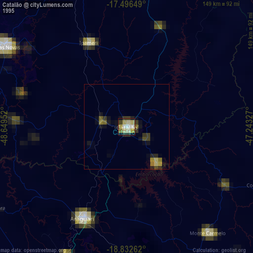
» NASA, Earths city lights 1995
» NASA city lights 2003
» Earth at Night: Flat Maps 2012, 2016