Caldas Novas night lights from space
Night Light of Caldas Novas (Goiás) from space (Brazil) Src. Average luminocity for 10x10km area is 66.171% and for 50x50km: 4.0143%.
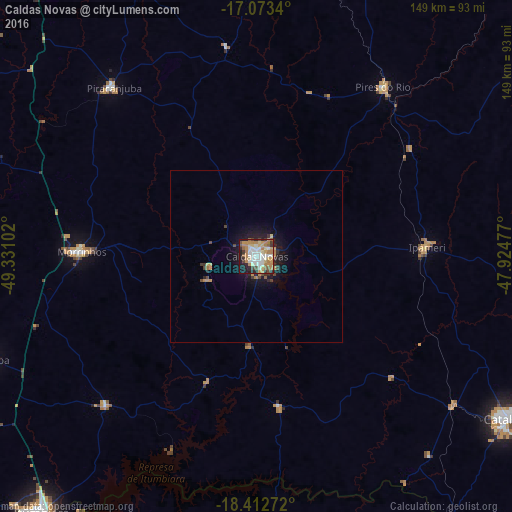
Analysis of Caldas Novas night lights 2016
Square area 10x10 km:
 12.99%
90-99
14.72%80-89
9.09%70-79
14.5%60-69
14.07%50-59
6.06%40-49
4.76%30-39
6.49%20-29
9.31%10-19
8.01%0-9
0%Square area 50x50 km:
0.49%90-99
0.56%80-89
0.39%70-79
0.83%60-69
0.72%50-59
0.29%40-49
0.57%30-39
0.52%20-29
0.84%10-19
3.03%0-9
91.75%Clear (daylight) street map image can be seen on geolist.org.
Map coordinates:
17° 4' 24.2" South, 49° 19' 51.7" West
17° 44' 39.5" South, 48° 37' 40.4" West
18° 24' 45.8" South, 47° 55' 29.2" West
Some cities around Caldas Novas sort by population:
• Catalão
86 km =53.4 mi,  123°
123°
• Morrinhos
50 km =31.1 mi,  271°
271°
• Goiatuba
82.5 km =51.3 mi,  248°
248°
• Pires do Rio
61.7 km =38.3 mi,  36°
36°
• Ipameri
49.6 km =30.8 mi,  87°
87°
• Piracanjuba
64.1 km =39.8 mi,  319°
319°
• Buriti Alegre
62 km =38.5 mi,  224°
224°
• Orizona
86.7 km =53.9 mi,  23°
23°
3468100 (p: 63,675)
Sources (retrieved 2019-11-25):
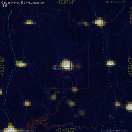
» NASA, Earths city lights 1995
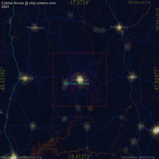
» NASA city lights 2003
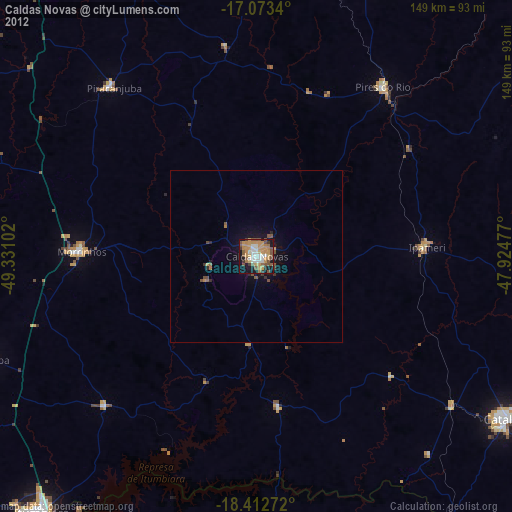
» Earth at Night: Flat Maps 2012, 2016