Caçador night lights from space
Night Light of Caçador (Santa Catarina) from space (Brazil) Src. Average luminocity for 10x10km area is 31.2698% and for 50x50km: 2.0933%.
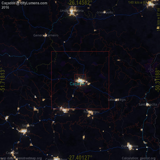
Analysis of Caçador night lights 2016
Square area 10x10 km:
 4.37%
4.37%90-99
5.16%80-89
2.98%70-79
4.76%60-69
8.73%50-59
3.97%40-49
0.6%30-39
2.38%20-29
1.39%10-19
36.71%0-9
28.97%Square area 50x50 km:
0.18%90-99
0.31%80-89
0.21%70-79
0.25%60-69
0.43%50-59
0.25%40-49
0.08%30-39
0.21%20-29
0.13%10-19
2.24%0-9
95.72%Clear (daylight) street map image can be seen on geolist.org.
Map coordinates:
26° 8' 45" South, 51° 43' 5.3" West
26° 46' 31" South, 51° 0' 54" West
27° 24' 4.6" South, 50° 18' 42.8" West
Some cities around Caçador sort by population:
• União da Vitória
61 km =37.9 mi,  353°
353°
• Videira
29.2 km =18.1 mi,  207°
207°
• Curitibanos
70.7 km =43.9 mi,  142°
142°
• Porto União
60.1 km =37.3 mi, 353°
• Capinzal
86.5 km =53.7 mi,  223°
223°
• Joaçaba
66 km =41 mi,  227°
227°
• Campos Novos
72.7 km =45.2 mi,  196°
196°
• Santa Cecília
61.9 km =38.5 mi,  109°
109°
3468570 (p: 63,726)
Sources (retrieved 2019-11-25):
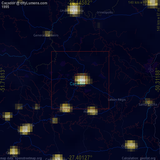
» NASA, Earths city lights 1995
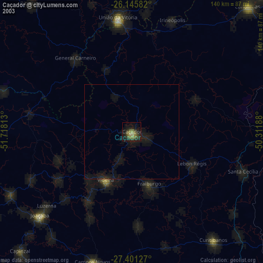
» NASA city lights 2003
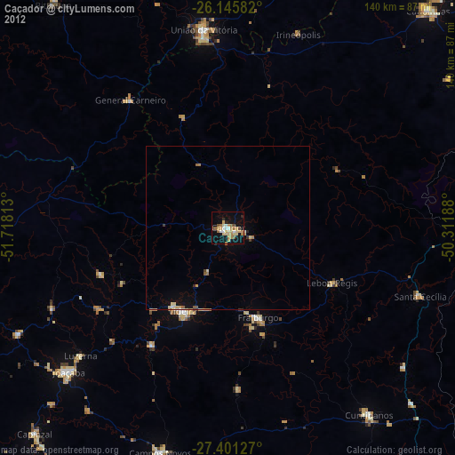
» Earth at Night: Flat Maps 2012, 2016