Mamanguape night lights from space
Night Light of Mamanguape (Paraíba) from space (Brazil) Src. Average luminocity for 10x10km area is 36.1861% and for 50x50km: 7.2636%.
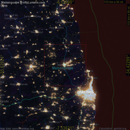
Analysis of Mamanguape night lights 2016
Square area 10x10 km:
 2.38%
2.38%90-99
4.33%80-89
9.74%70-79
6.93%60-69
5.41%50-59
4.11%40-49
3.9%30-39
3.68%20-29
5.63%10-19
36.36%0-9
17.53%Square area 50x50 km:
0.13%90-99
0.35%80-89
1.11%70-79
0.55%60-69
1.04%50-59
1.36%40-49
1.71%30-39
1.48%20-29
2.1%10-19
5.11%0-9
85.07%Clear (daylight) street map image can be seen on geolist.org.
Map coordinates:
6° 8' 24" South, 35° 49' 45.3" West
6° 50' 19" South, 35° 7' 34" West
7° 32' 10.4" South, 34° 25' 22.8" West
Some cities around Mamanguape sort by population:
• Santa Rita
34.7 km =21.6 mi,  151°
151°
• Bayeux
38.4 km =23.9 mi, 146°
• Cabedelo
35.9 km =22.3 mi,  116°
116°
• Guarabira
40.2 km =25 mi,  267°
267°
• Mari
32.6 km =20.3 mi,  220°
220°
• Rio Tinto
6.4 km =4 mi,  51°
51°
• Jacaraú
31.2 km =19.4 mi,  323°
323°
• Cruz do Espírito Santo
33.8 km =21 mi,  172°
172°
3395717 (p: 27,606)
Sources (retrieved 2019-11-25):
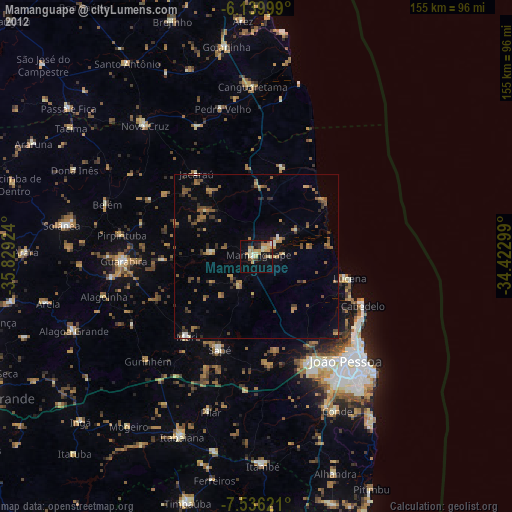
» Earth at Night: Flat Maps 2012, 2016