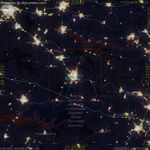
Botucatu night lights from space
Night Light of Botucatu (São Paulo) from space (Brazil) Src. Average luminocity for 10x10km area is 64.9583% and for 50x50km: 7.3135%.

Analysis of Botucatu night lights 2016
Square area 10x10 km:
 14.88%
90-99
15.48%80-89
8.53%70-79
14.68%60-69
9.13%50-59
3.17%40-49
5.75%30-39
8.13%20-29
9.72%10-19
10.52%0-9
0%Square area 50x50 km:
0.82%90-99
0.88%80-89
0.85%70-79
1.62%60-69
1.05%50-59
0.65%40-49
1.03%30-39
1.15%20-29
1.45%10-19
5.11%0-9
85.4%Clear (daylight) street map image can be seen on geolist.org.
Map coordinates:
22° 14' 11.5" South, 49° 8' 53.3" West
22° 53' 9" South, 48° 26' 42" West
23° 31' 55.4" South, 47° 44' 30.8" West
Some cities around Botucatu sort by population:
• Avaré
54.6 km =33.9 mi,  244°
244°
• Lençóis Paulista
48.4 km =30.1 mi,  311°
311°
• Barra Bonita
45 km =28 mi,  345°
345°
• São Manuel
21.5 km =13.4 mi,  323°
323°
• Igaraçu do Tietê
43.4 km =27 mi,  344°
344°
• Macatuba
50.7 km =31.5 mi,  327°
327°
• Itatinga
29.7 km =18.5 mi,  216°
216°
• Conchas
46.8 km =29.1 mi,  107°
107°
3469136 (p: 113,862)
Sources (retrieved 2019-11-25):
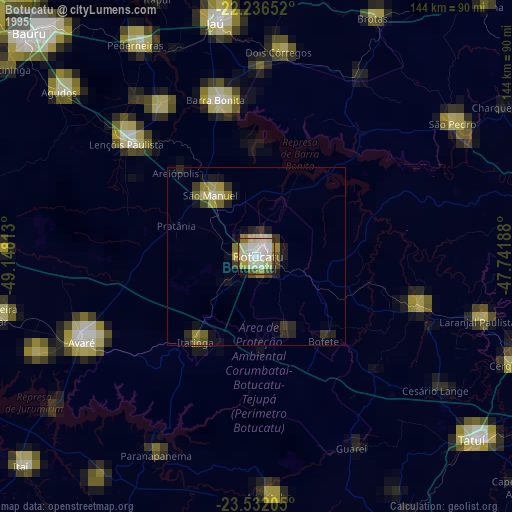
» NASA, Earths city lights 1995
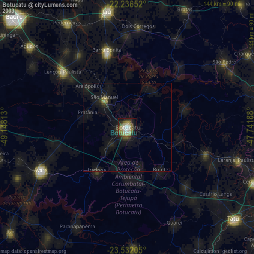
» NASA city lights 2003
» Earth at Night: Flat Maps 2012, 2016