Macatuba night lights from space
Night Light of Macatuba (São Paulo) from space (Brazil) Src. Average luminocity for 10x10km area is 10.1383% and for 50x50km: 9.8634%.
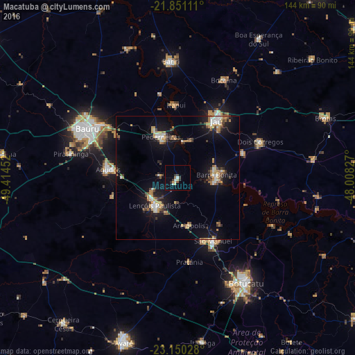
Analysis of Macatuba night lights 2016
Square area 10x10 km:
 0.95%
0.95%90-99
2.08%80-89
1.33%70-79
0.95%60-69
0.76%50-59
0.76%40-49
1.52%30-39
2.65%20-29
0.57%10-19
0.57%0-9
87.88%Square area 50x50 km:
1.08%90-99
1.16%80-89
0.97%70-79
1.74%60-69
1.31%50-59
0.84%40-49
1.36%30-39
1.36%20-29
1.48%10-19
9.28%0-9
79.43%Clear (daylight) street map image can be seen on geolist.org.
Map coordinates:
21° 51' 4" South, 49° 24' 52.3" West
22° 30' 8" South, 48° 42' 41" West
23° 9' 1" South, 48° 0' 29.8" West
Some cities around Macatuba sort by population:
• Jaú
27.8 km =17.3 mi,  34°
34°
• Lençóis Paulista
14.1 km =8.8 mi,  220°
220°
• Pederneiras
18 km =11.2 mi,  338°
338°
• Barra Bonita
15.8 km =9.8 mi,  86°
86°
• São Manuel
29.3 km =18.2 mi,  150°
150°
• Agudos
28.6 km =17.8 mi,  277°
277°
• Igaraçu do Tietê
15.8 km =9.8 mi, 92°
• Itapuí
29.9 km =18.6 mi,  358°
358°
3458245 (p: 16,179)
Sources (retrieved 2019-11-25):
» Earth at Night: Flat Maps 2012, 2016