Bom Jesus da Lapa night lights from space
Night Light of Bom Jesus da Lapa (Bahia) from space (Brazil) Src. Average luminocity for 10x10km area is 27.8182% and for 50x50km: 1.7218%.
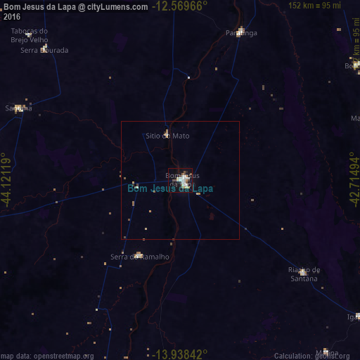

Analysis of Bom Jesus da Lapa night lights 2016
Square area 10x10 km:
 5.41%
5.41%90-99
6.71%80-89
3.68%70-79
2.16%60-69
1.08%50-59
3.03%40-49
4.33%30-39
1.3%20-29
3.03%10-19
25.11%0-9
44.16%Square area 50x50 km:
0.21%90-99
0.31%80-89
0.2%70-79
0.25%60-69
0.11%50-59
0.26%40-49
0.25%30-39
0.12%20-29
0.19%10-19
1.05%0-9
97.03%Clear (daylight) street map image can be seen on geolist.org.
Map coordinates:
12° 34' 10.8" South, 44° 7' 16.3" West
13° 15' 18" South, 43° 25' 5" West
13° 56' 18.3" South, 42° 42' 53.8" West
Some cities around Bom Jesus da Lapa sort by population:
• Santa Maria da Vitória
85.7 km =53.3 mi,  260°
260°
• Ibotirama
120.9 km =75.1 mi,  10°
10°
• Macaúbas
82.2 km =51.1 mi,  71°
71°
• Riacho de Santana
65.1 km =40.5 mi,  127°
127°
• Paratinga
67.7 km =42.1 mi,  21°
21°
• Palmas de Monte Alto
115.9 km =72 mi,  166°
166°
• Boquira
88.6 km =55.1 mi,  57°
57°
• Oliveira dos Brejinhos
118.7 km =73.8 mi,  28°
28°
3469437 (p: 40,691)
Sources (retrieved 2019-11-25):
» Earth at Night: Flat Maps 2012, 2016