Poá night lights from space
Night Light of Poá (São Paulo) from space (Brazil) Src. Average luminocity for 10x10km area is 94.5853% and for 50x50km: 60.4375%.
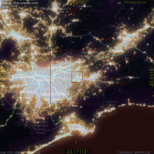
Analysis of Poá night lights 2016
Square area 10x10 km:
 47.42%
90-99
30.95%80-89
5.75%70-79
15.87%60-69
0%50-59
0%40-49
0%30-39
0%20-29
0%10-19
0%0-9
0%Square area 50x50 km:
25.35%90-99
9.64%80-89
3.99%70-79
6.27%60-69
8.33%50-59
8.06%40-49
5.77%30-39
5.09%20-29
7.44%10-19
10%0-9
10.05%Clear (daylight) street map image can be seen on geolist.org.
Map coordinates:
22° 52' 54.6" South, 47° 2' 52.3" West
23° 31' 41" South, 46° 20' 41" West
24° 10' 16.1" South, 45° 38' 29.8" West
Some cities around Poá sort by population:
• Guarulhos
20.6 km =12.8 mi,  290°
290°
• Mauá
19.6 km =12.2 mi,  217°
217°
• Itaquaquecetuba
4.7 km =2.9 mi,  355°
355°
• Mogi das Cruzes
16 km =9.9 mi,  87°
87°
• Suzano
3.8 km =2.4 mi,  114°
114°
• Ferraz de Vasconcelos
2.8 km =1.7 mi,  239°
239°
• Ribeirão Pires
21.5 km =13.4 mi,  199°
199°
• Arujá
14.9 km =9.3 mi,  9°
9°
3453406 (p: 107,432)
Sources (retrieved 2019-11-25):
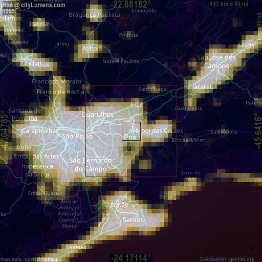
» NASA, Earths city lights 1995
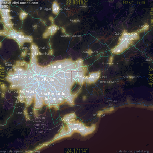
» NASA city lights 2003
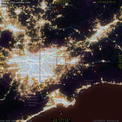
» Earth at Night: Flat Maps 2012, 2016