Mogi das Cruzes night lights from space
Night Light of Mogi das Cruzes (São Paulo) from space (Brazil) Src. Average luminocity for 10x10km area is 78.8631% and for 50x50km: 40.5032%.
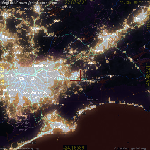

Analysis of Mogi das Cruzes night lights 2016
Square area 10x10 km:
 23.61%
90-99
24.8%80-89
8.73%70-79
7.54%60-69
12.1%50-59
10.12%40-49
6.94%30-39
4.76%20-29
1.39%10-19
0%0-9
0%Square area 50x50 km:
7.5%90-99
6.19%80-89
3.52%70-79
6.18%60-69
8.08%50-59
8.68%40-49
6.53%30-39
6.06%20-29
8.55%10-19
12.83%0-9
25.88%Clear (daylight) street map image can be seen on geolist.org.
Map coordinates:
22° 52' 35.5" South, 46° 53' 29.3" West
23° 31' 22" South, 46° 11' 18" West
24° 9' 57.2" South, 45° 29' 6.8" West
Some cities around Mogi das Cruzes sort by population:
• Itaquaquecetuba
16.8 km =10.4 mi,  284°
284°
• Suzano
12.7 km =7.9 mi,  260°
260°
• Ferraz de Vasconcelos
18.5 km =11.5 mi, 263°
• Poá
16 km =9.9 mi,  267°
267°
• Arujá
19.5 km =12.1 mi,  316°
316°
• Santa Isabel
23.3 km =14.5 mi,  351°
351°
• Biritiba Mirim
16.2 km =10.1 mi,  109°
109°
• Guararema
19.7 km =12.2 mi,  52°
52°
3457001 (p: 325,746)
Sources (retrieved 2019-11-25):
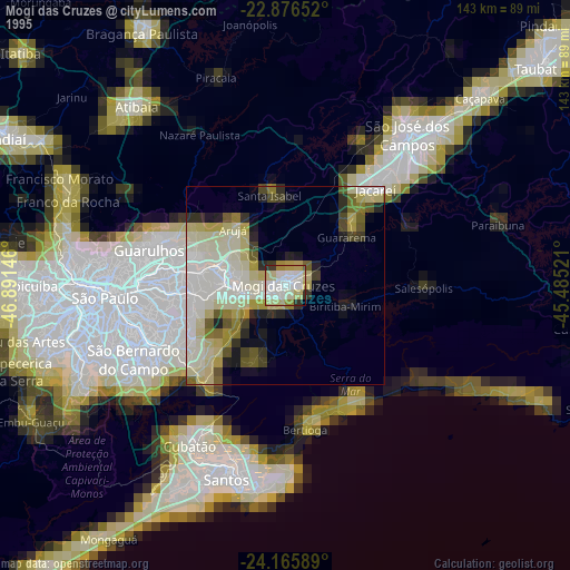
» NASA, Earths city lights 1995
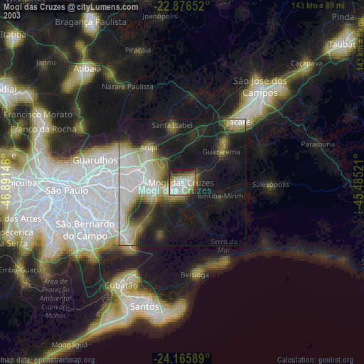
» NASA city lights 2003
» Earth at Night: Flat Maps 2012, 2016