Alpinópolis night lights from space
Night Light of Alpinópolis (Minas Gerais) from space (Brazil) Src. Average luminocity for 10x10km area is 5.0714% and for 50x50km: 2.0018%.
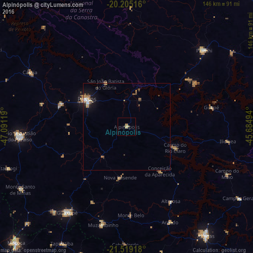
Analysis of Alpinópolis night lights 2016
Square area 10x10 km:
 0%
0%90-99
0%80-89
0.79%70-79
3.77%60-69
0.99%50-59
0%40-49
0%30-39
0.2%20-29
0.6%10-19
0%0-9
93.65%Square area 50x50 km:
0.18%90-99
0.26%80-89
0.17%70-79
0.52%60-69
0.35%50-59
0.32%40-49
0.18%30-39
0.2%20-29
0.33%10-19
1.22%0-9
96.29%Clear (daylight) street map image can be seen on geolist.org.
Map coordinates:
20° 12' 18.6" South, 47° 5' 28.3" West
20° 51' 49" South, 46° 23' 17" West
21° 31' 9" South, 45° 41' 5.8" West
Some cities around Alpinópolis sort by population:
• Passos
28.1 km =17.5 mi,  304°
304°
• Guaxupé
59.6 km =37 mi,  214°
214°
• Piuí
63 km =39.1 mi,  45°
45°
• Muzambinho
58.7 km =36.5 mi,  194°
194°
• Itaú de Minas
40.3 km =25 mi,  290°
290°
• Carmo do Rio Claro
30.4 km =18.9 mi,  113°
113°
• Areado
60.5 km =37.6 mi,  155°
155°
• Alterosa
49.8 km =30.9 mi,  149°
149°
3472507 (p: 13,286)
Sources (retrieved 2019-11-25):
» Earth at Night: Flat Maps 2012, 2016