Alagoinhas night lights from space
Night Light of Alagoinhas (Bahia) from space (Brazil) Src. Average luminocity for 10x10km area is 68.5868% and for 50x50km: 9.8793%.
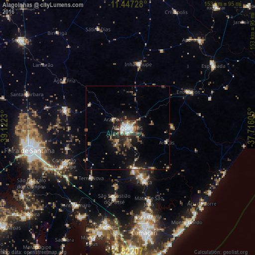
Analysis of Alagoinhas night lights 2016
Square area 10x10 km:
 15.08%
90-99
27.07%80-89
3.93%70-79
5.17%60-69
8.68%50-59
8.68%40-49
4.13%30-39
13.22%20-29
13.02%10-19
1.03%0-9
0%Square area 50x50 km:
0.75%90-99
1.57%80-89
0.8%70-79
0.72%60-69
1.3%50-59
1.78%40-49
1.96%30-39
2.29%20-29
3.95%10-19
6.86%0-9
78.03%Clear (daylight) street map image can be seen on geolist.org.
Map coordinates:
11° 26' 50.2" South, 39° 7' 20.3" West
12° 8' 8" South, 38° 25' 9" West
12° 49' 19.5" South, 37° 42' 57.8" West
Some cities around Alagoinhas sort by population:
• Catu
24.6 km =15.3 mi,  169°
169°
• São Sebastião do Passé
42.7 km =26.5 mi,  191°
191°
• Entre Rios
42.3 km =26.3 mi,  59°
59°
• Mata de São João
45.8 km =28.5 mi,  163°
163°
• Conceição do Jacuípe
42.8 km =26.6 mi,  241°
241°
• Inhambupe
39.7 km =24.7 mi,  10°
10°
• Irará
39 km =24.2 mi,  284°
284°
• Coração de Maria
37.6 km =23.4 mi,  253°
253°
3472766 (p: 122,688)
Sources (retrieved 2019-11-25):
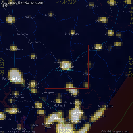
» NASA, Earths city lights 1995
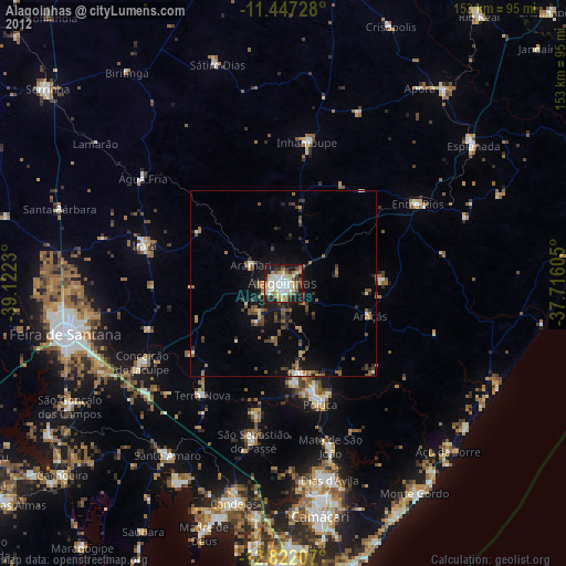
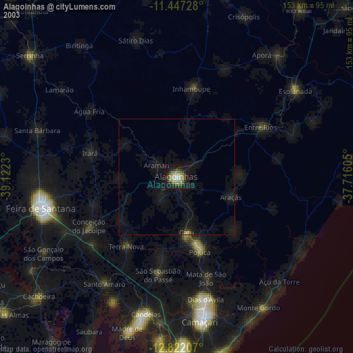
» NASA city lights 2003
» Earth at Night: Flat Maps 2012, 2016