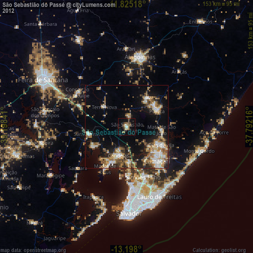
São Sebastião do Passé night lights from space
Night Light of São Sebastião do Passé (Bahia) from space (Brazil) Src. Average luminocity for 10x10km area is 23.6407% and for 50x50km: 24.3187%.
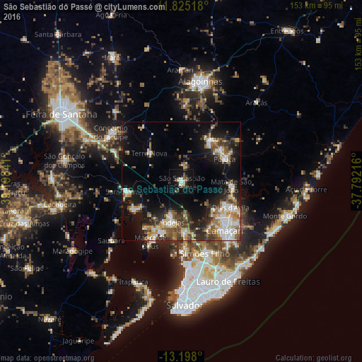
Analysis of São Sebastião do Passé night lights 2016
Square area 10x10 km:
 0.43%
0.43%90-99
6.06%80-89
4.33%70-79
0%60-69
0.43%50-59
4.11%40-49
4.11%30-39
5.84%20-29
5.63%10-19
24.24%0-9
44.81%Square area 50x50 km:
2.42%90-99
6.12%80-89
2.29%70-79
2.18%60-69
3.19%50-59
4.18%40-49
3.75%30-39
4.14%20-29
5.77%10-19
14.19%0-9
51.78%Clear (daylight) street map image can be seen on geolist.org.
Map coordinates:
11° 49' 30.6" South, 39° 11' 54.3" West
12° 30' 45" South, 38° 29' 43" West
13° 11' 52.8" South, 37° 47' 31.8" West
Some cities around São Sebastião do Passé sort by population:
• Camaçari
27.7 km =17.2 mi,  137°
137°
• Simões Filho
31.8 km =19.8 mi,  161°
161°
• Santo Amaro
23.8 km =14.8 mi,  260°
260°
• Catu
21.8 km =13.5 mi,  35°
35°
• Mata de São João
21.4 km =13.3 mi,  95°
95°
• São Francisco do Conde
23.8 km =14.8 mi,  237°
237°
• Conceição do Jacuípe
36.6 km =22.7 mi,  306°
306°
• Madre de Deus
28.8 km =17.9 mi,  208°
208°
3448219 (p: 31,049)
Sources (retrieved 2019-11-25):
» Earth at Night: Flat Maps 2012, 2016