Coração de Maria night lights from space
Night Light of Coração de Maria (Bahia) from space (Brazil) Src. Average luminocity for 10x10km area is 18.812% and for 50x50km: 22.3566%.
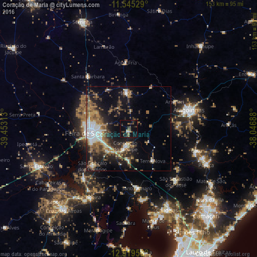
Analysis of Coração de Maria night lights 2016
Square area 10x10 km:
 0.83%
0.83%90-99
1.65%80-89
1.24%70-79
0.41%60-69
2.27%50-59
4.34%40-49
6.2%30-39
4.34%20-29
4.75%10-19
15.5%0-9
58.47%Square area 50x50 km:
2.62%90-99
4.19%80-89
1.6%70-79
1.84%60-69
3.83%50-59
5.12%40-49
4.04%30-39
3.41%20-29
5.9%10-19
12.85%0-9
54.6%Clear (daylight) street map image can be seen on geolist.org.
Map coordinates:
11° 32' 43" South, 39° 27' 11.3" West
12° 13' 60" South, 38° 45' 0" West
12° 55' 10.5" South, 38° 2' 48.8" West
Some cities around Coração de Maria sort by population:
• Feira de Santana
23.8 km =14.8 mi,  261°
261°
• Alagoinhas
37.6 km =23.4 mi,  73°
73°
• Santo Amaro
35.1 km =21.8 mi,  173°
173°
• São Sebastião do Passé
41.6 km =25.8 mi,  138°
138°
• Conceição do Jacuípe
9.4 km =5.8 mi,  191°
191°
• Conceição da Feira
40.6 km =25.2 mi,  221°
221°
• São Gonçalo dos Campos
32.4 km =20.1 mi,  226°
226°
• Irará
20.5 km =12.7 mi,  354°
354°
3465541 (p: 6,571)
Sources (retrieved 2019-11-25):
» Earth at Night: Flat Maps 2012, 2016