Bujumbura night lights from space
Night Light of Bujumbura (Bujumbura Mairie) from space (Burundi) Src. Average luminocity for 10x10km area is 29.5974% and for 50x50km: 1.4842%.
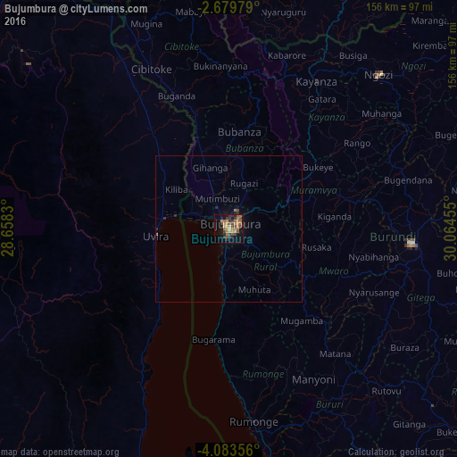
Analysis of Bujumbura night lights 2016
Square area 10x10 km:
 0%
0%90-99
0.87%80-89
3.03%70-79
7.14%60-69
10.61%50-59
6.49%40-49
6.93%30-39
6.28%20-29
5.41%10-19
15.8%0-9
37.45%Square area 50x50 km:
0%90-99
0.03%80-89
0.12%70-79
0.29%60-69
0.49%50-59
0.26%40-49
0.31%30-39
0.3%20-29
0.35%10-19
0.76%0-9
97.08%Clear (daylight) street map image can be seen on geolist.org.
Map coordinates:
2° 40' 47.2" South, 28° 39' 29.9" East
3° 22' 54.9" South, 29° 21' 41.1" East
4° 5' 0.8" South, 30° 3' 52.4" East
Some cities around Bujumbura sort by population:
• Uvira, CD
24.9 km =15.5 mi,  266°
266°
• Gitega
62.7 km =39 mi,  94°
94°
• Kayanza
59.1 km =36.7 mi,  30°
30°
• Muramvya
30.1 km =18.7 mi,  65°
65°
• Cibitoke
61 km =37.9 mi,  334°
334°
• Bubanza
33.7 km =20.9 mi,  5°
5°
• Mwaro
40.6 km =25.2 mi,  110°
110°
• Isale
14.1 km =8.8 mi, 74°
425378 (p: 331,700)
Sources (retrieved 2019-11-25):
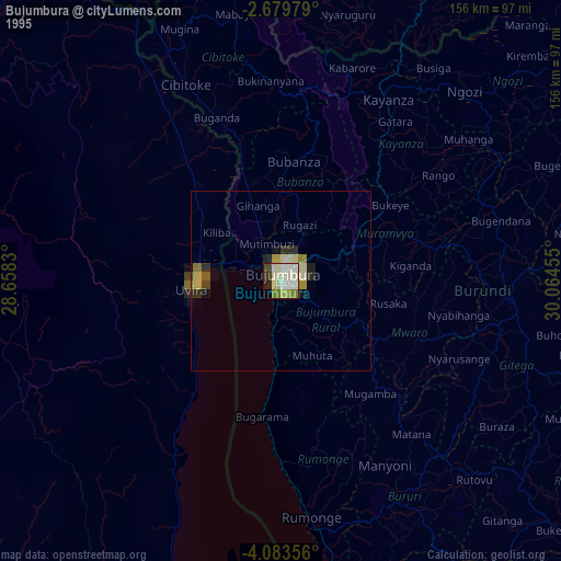
» NASA, Earths city lights 1995
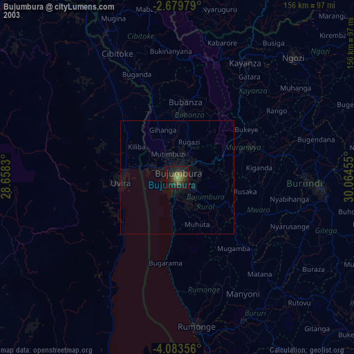
» NASA city lights 2003
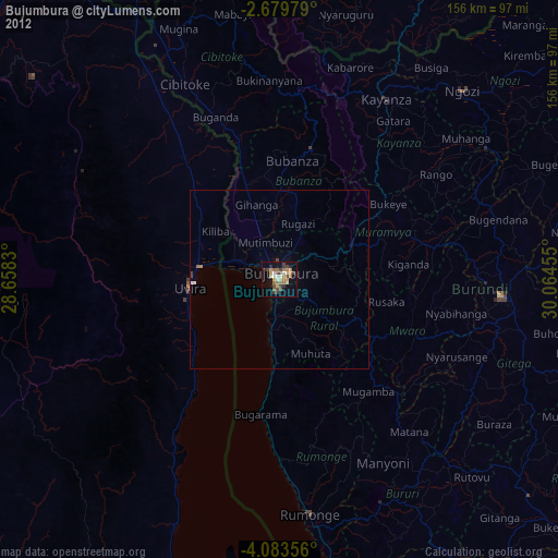
» Earth at Night: Flat Maps 2012, 2016