Uvira night lights from space
Night Light of Uvira (South Kivu) from space (Democratic Republic of the Congo) Src. Average luminocity for 10x10km area is 0.9416% and for 50x50km: 0.5663%.
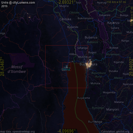

Analysis of Uvira night lights 2016
Square area 10x10 km:
 0%
0%90-99
0%80-89
0%70-79
0%60-69
0.87%50-59
0%40-49
0%30-39
0.22%20-29
1.08%10-19
0%0-9
97.84%Square area 50x50 km:
0%90-99
0%80-89
0.03%70-79
0.14%60-69
0.2%50-59
0.08%40-49
0.05%30-39
0.12%20-29
0.22%10-19
0.26%0-9
98.91%Clear (daylight) street map image can be seen on geolist.org.
Map coordinates:
2° 41' 35.6" South, 28° 26' 4.8" East
3° 23' 43.2" South, 29° 8' 16" East
4° 5' 49.1" South, 29° 50' 27.3" East
Some cities around Uvira sort by population:
• Bujumbura, BI
24.9 km =15.5 mi,  86°
86°
• Kayanza, BI
75.8 km =47.1 mi,  46°
46°
• Muramvya, BI
54.1 km =33.6 mi,  74°
74°
• Cibitoke, BI
56.6 km =35.2 mi,  358°
358°
• Bubanza, BI
44.9 km =27.9 mi,  38°
38°
• Rumonge, BI
72.4 km =45 mi,  152°
152°
• Mwaro, BI
64.1 km =39.8 mi,  101°
101°
• Isale, BI
38.8 km =24.1 mi,  82°
82°
204405 (p: 170,391)
Sources (retrieved 2019-11-25):
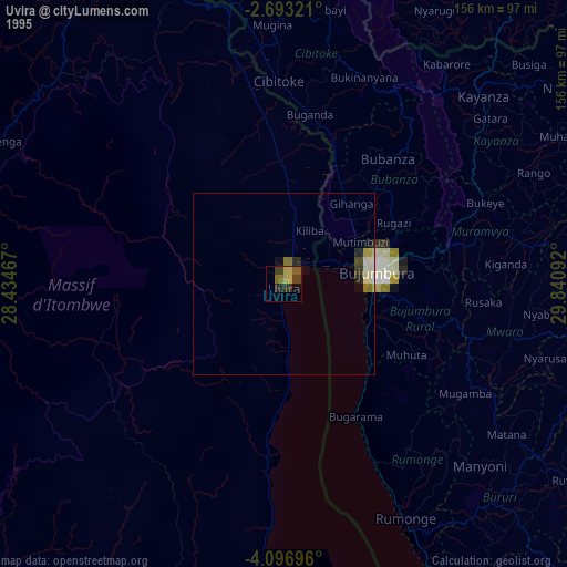
» NASA, Earths city lights 1995
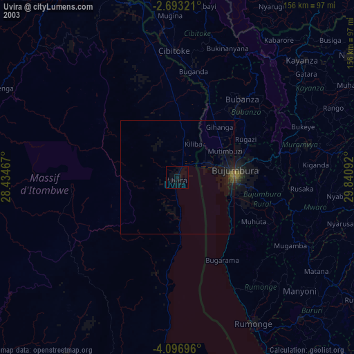
» NASA city lights 2003
» Earth at Night: Flat Maps 2012, 2016