Kavarna night lights from space
Night Light of Kavarna (Dobrich) from space (Bulgaria) Src. Average luminocity for 10x10km area is 4.5857% and for 50x50km: 1.0904%.
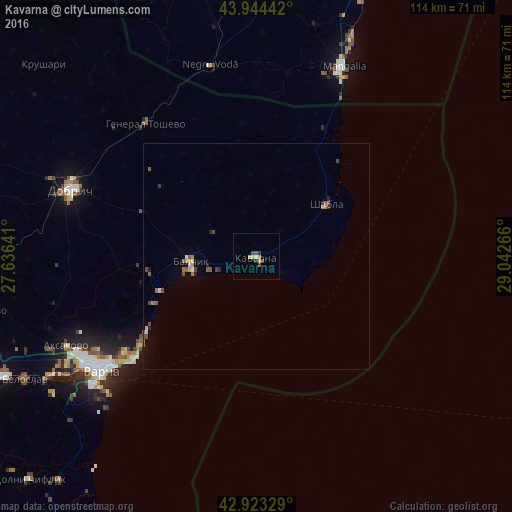
Analysis of Kavarna night lights 2016
Square area 10x10 km:
 0%
0%90-99
0.32%80-89
1.11%70-79
1.11%60-69
0.63%50-59
0%40-49
2.06%30-39
0.48%20-29
1.27%10-19
0%0-9
93.02%Square area 50x50 km:
0.07%90-99
0.09%80-89
0.08%70-79
0.11%60-69
0.21%50-59
0.3%40-49
0.32%30-39
0.11%20-29
0.22%10-19
0.08%0-9
98.4%Clear (daylight) street map image can be seen on geolist.org.
Map coordinates:
43° 56' 39.9" North, 27° 38' 11.1" East
43° 26' 9.6" North, 28° 20' 22.3" East
42° 55' 23.8" North, 29° 2' 33.6" East
Some cities around Kavarna sort by population:
• Varna
42 km =26.1 mi,  234°
234°
• Dobrich
43.3 km =26.9 mi,  289°
289°
• Mangalia, RO
45 km =28 mi,  25°
25°
• Asparuhovo
46.3 km =28.8 mi, 232°
• Balchik
14.7 km =9.1 mi,  263°
263°
• Zlatni Pyasatsi
29.3 km =18.2 mi,  235°
235°
• General Toshevo
38.2 km =23.7 mi,  320°
320°
• Negru Vodă, RO
43.8 km =27.2 mi,  345°
345°
730518 (p: 11,205)
Sources (retrieved 2019-11-25):
» Earth at Night: Flat Maps 2012, 2016