Balchik night lights from space
Night Light of Balchik (Dobrich) from space (Bulgaria) Src. Average luminocity for 10x10km area is 10.519% and for 50x50km: 3.9561%.
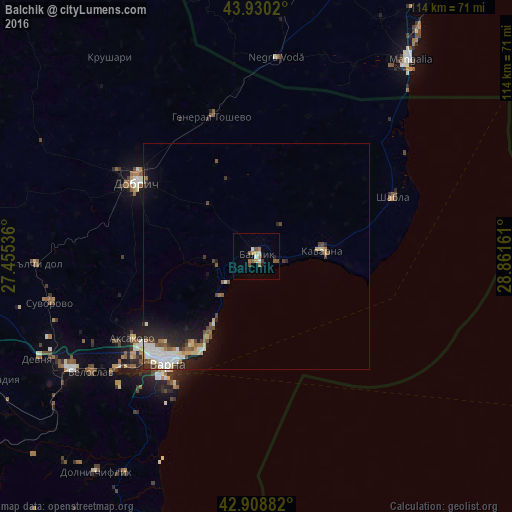
Analysis of Balchik night lights 2016
Square area 10x10 km:
 1.43%
1.43%90-99
1.11%80-89
0.32%70-79
1.59%60-69
2.54%50-59
3.17%40-49
0.63%30-39
0.63%20-29
1.27%10-19
0%0-9
87.3%Square area 50x50 km:
0.69%90-99
0.79%80-89
0.39%70-79
0.28%60-69
0.49%50-59
0.59%40-49
0.64%30-39
0.28%20-29
1.09%10-19
2.01%0-9
92.74%Clear (daylight) street map image can be seen on geolist.org.
Map coordinates:
43° 55' 48.7" North, 27° 27' 19.3" East
43° 25' 18" North, 28° 9' 30.5" East
42° 54' 31.8" North, 28° 51' 41.8" East
Some cities around Balchik sort by population:
• Varna
30 km =18.6 mi,  220°
220°
• Dobrich
30.8 km =19.1 mi,  301°
301°
• Asparuhovo
34.6 km =21.5 mi, 219°
• Kavarna
14.7 km =9.1 mi,  83°
83°
• Zlatni Pyasatsi
17.9 km =11.1 mi,  211°
211°
• General Toshevo
32.6 km =20.3 mi,  342°
342°
• Aksakovo
32.9 km =20.4 mi,  236°
236°
• Negru Vodă, RO
44 km =27.3 mi,  4°
4°
733515 (p: 13,000)
Sources (retrieved 2019-11-25):
» Earth at Night: Flat Maps 2012, 2016