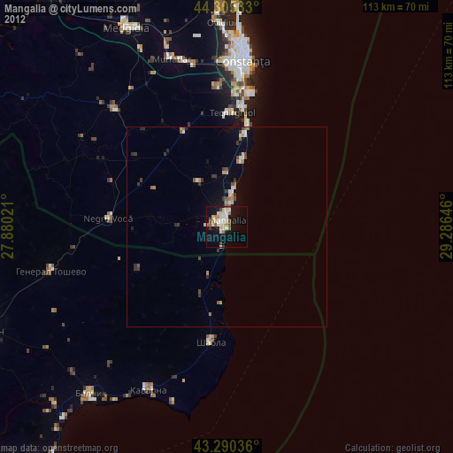
Mangalia night lights from space
Night Light of Mangalia (Constanța) from space (Romania) Src. Average luminocity for 10x10km area is 16.8561% and for 50x50km: 1.4236%.
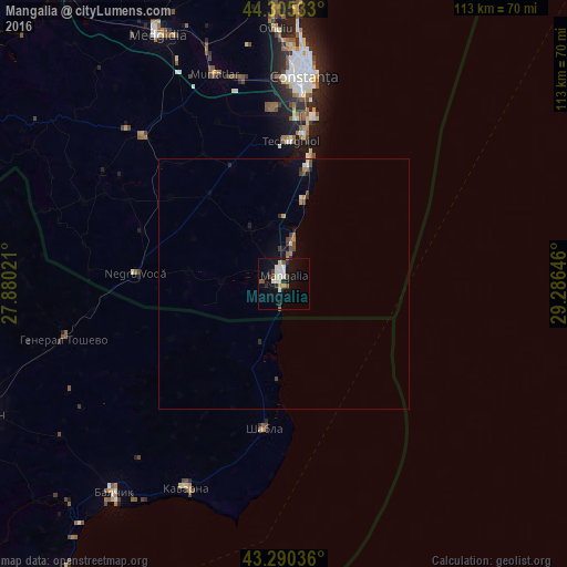
Analysis of Mangalia night lights 2016
Square area 10x10 km:
 2.42%
2.42%90-99
5.15%80-89
0.91%70-79
0.45%60-69
1.06%50-59
2.12%40-49
1.36%30-39
1.97%20-29
3.03%10-19
13.79%0-9
67.73%Square area 50x50 km:
0.11%90-99
0.27%80-89
0.09%70-79
0.1%60-69
0.19%50-59
0.19%40-49
0.28%30-39
0.17%20-29
0.34%10-19
0.8%0-9
97.48%Clear (daylight) street map image can be seen on geolist.org.
Map coordinates:
44° 18' 19.2" North, 27° 52' 48.8" East
43° 48' 0" North, 28° 34' 60" East
43° 17' 25.3" North, 29° 17' 11.3" East
Some cities around Mangalia sort by population:
• Cumpăna
35.2 km =21.9 mi,  357°
357°
• Eforie Sud
25.3 km =15.7 mi,  12°
12°
• Valu lui Traian
41.8 km =26 mi,  347°
347°
• Techirghiol
27.8 km =17.3 mi,  2°
2°
• Tuzla
22.6 km =14 mi, 10°
• Negru Vodă
30.8 km =19.1 mi,  273°
273°
• Agigea
32.6 km =20.3 mi, 3°
• Topraisar
26.4 km =16.4 mi,  336°
336°
673921 (p: 39,619)
Sources (retrieved 2019-11-25):
» Earth at Night: Flat Maps 2012, 2016