Asparuhovo night lights from space
Night Light of Asparuhovo (Varna) from space (Bulgaria) Src. Average luminocity for 10x10km area is 43.7106% and for 50x50km: 6.6632%.
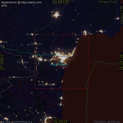
Analysis of Asparuhovo night lights 2016
Square area 10x10 km:
 11.06%
90-99
11.82%80-89
3.48%70-79
1.67%60-69
3.64%50-59
3.79%40-49
4.7%30-39
5.15%20-29
21.36%10-19
19.09%0-9
14.24%Square area 50x50 km:
0.91%90-99
1.11%80-89
0.65%70-79
0.43%60-69
0.79%50-59
1.12%40-49
0.96%30-39
0.93%20-29
2.35%10-19
4.35%0-9
86.39%Clear (daylight) street map image can be seen on geolist.org.
Map coordinates:
43° 41' 28.4" North, 27° 11' 6.4" East
43° 10' 50.4" North, 27° 53' 17.6" East
42° 39' 56.9" North, 28° 35' 28.9" East
Some cities around Asparuhovo sort by population:
• Varna
4.6 km =2.9 mi,  29°
29°
• Provadia
36.9 km =22.9 mi,  270°
270°
• Balchik
34.6 km =21.5 mi,  39°
39°
• Zlatni Pyasatsi
17 km =10.6 mi,  47°
47°
• Devnya
26.2 km =16.3 mi,  280°
280°
• Beloslav
14.9 km =9.3 mi, 273°
• Dolni Chiflik
25.1 km =15.6 mi,  213°
213°
• Aksakovo
10 km =6.2 mi,  327°
327°
733606 (p: 27,000)
Sources (retrieved 2019-11-25):
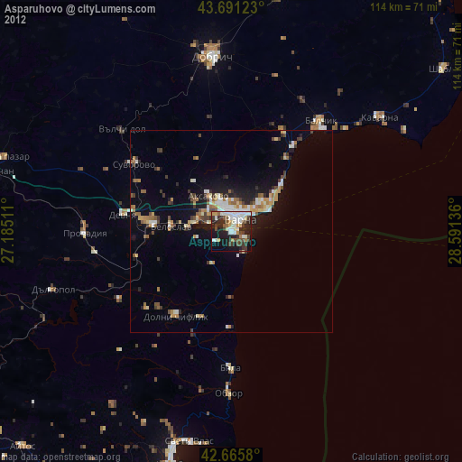
» Earth at Night: Flat Maps 2012, 2016