Dobrich night lights from space
Night Light of Dobrich from space (Bulgaria) Src. Average luminocity for 10x10km area is 21.6286% and for 50x50km: 1.3656%.
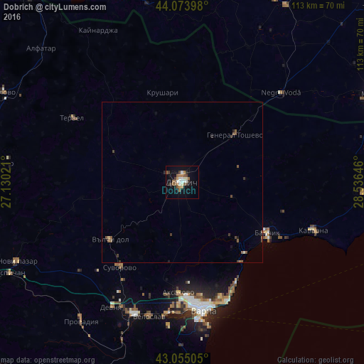
Analysis of Dobrich night lights 2016
Square area 10x10 km:
 2.54%
2.54%90-99
4.13%80-89
1.59%70-79
1.27%60-69
4.6%50-59
4.92%40-49
2.54%30-39
1.9%20-29
1.9%10-19
17.3%0-9
57.3%Square area 50x50 km:
0.1%90-99
0.18%80-89
0.09%70-79
0.05%60-69
0.23%50-59
0.46%40-49
0.26%30-39
0.22%20-29
0.17%10-19
0.75%0-9
97.5%Clear (daylight) street map image can be seen on geolist.org.
Map coordinates:
44° 4' 26.3" North, 27° 7' 48.8" East
43° 34' 0" North, 27° 49' 60" East
43° 3' 18.2" North, 28° 32' 11.3" East
Some cities around Dobrich sort by population:
• Varna
39.5 km =24.5 mi,  170°
170°
• Asparuhovo
43.1 km =26.8 mi, 174°
• Balchik
30.8 km =19.1 mi,  121°
121°
• Zlatni Pyasatsi
35.6 km =22.1 mi,  151°
151°
• General Toshevo
22.2 km =13.8 mi,  47°
47°
• Aksakovo
34.5 km =21.4 mi,  181°
181°
• Tervel
39.6 km =24.6 mi,  300°
300°
• Negru Vodă, RO
40.5 km =25.2 mi, 46°
726418 (p: 94,831)
Sources (retrieved 2019-11-25):
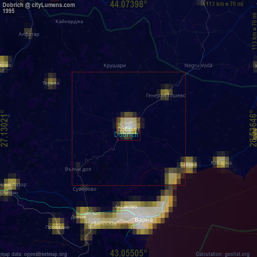
» NASA, Earths city lights 1995
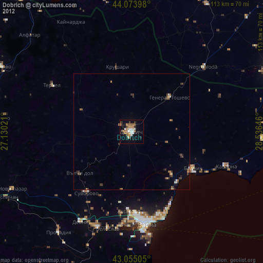
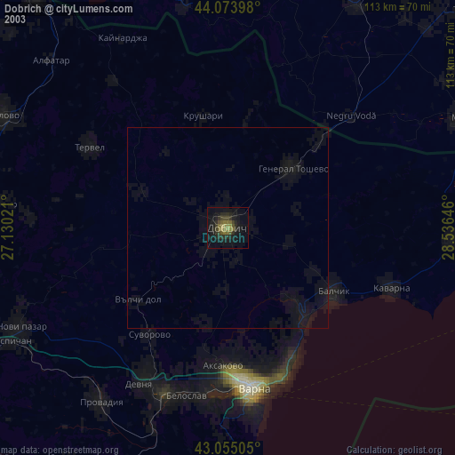
» NASA city lights 2003
» Earth at Night: Flat Maps 2012, 2016