Karnobat night lights from space
Night Light of Karnobat (Burgas) from space (Bulgaria) Src. Average luminocity for 10x10km area is 4.397% and for 50x50km: 0.93%.
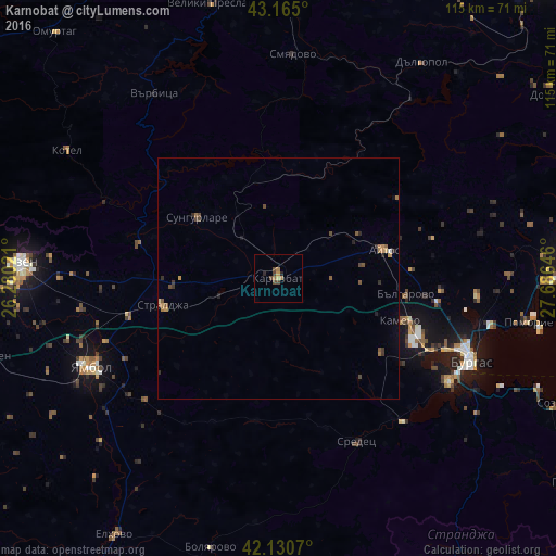
Analysis of Karnobat night lights 2016
Square area 10x10 km:
 0%
0%90-99
0%80-89
0.45%70-79
0.76%60-69
1.52%50-59
0.3%40-49
3.03%30-39
0%20-29
1.21%10-19
0%0-9
92.73%Square area 50x50 km:
0%90-99
0.03%80-89
0.05%70-79
0.21%60-69
0.2%50-59
0.18%40-49
0.37%30-39
0.16%20-29
0.25%10-19
0.1%0-9
98.44%Clear (daylight) street map image can be seen on geolist.org.
Map coordinates:
43° 9' 54" North, 26° 16' 48.8" East
42° 39' 0" North, 26° 58' 60" East
42° 7' 50.5" North, 27° 41' 11.3" East
Some cities around Karnobat sort by population:
• Burgas
42.8 km =26.6 mi,  111°
111°
• Sliven
53.6 km =33.3 mi,  274°
274°
• Yambol
43.7 km =27.2 mi,  244°
244°
• Aytos
22.5 km =14 mi,  75°
75°
• Sredets
37.3 km =23.2 mi,  154°
154°
• Kotel
50.7 km =31.5 mi,  300°
300°
• Straldzha
25.2 km =15.7 mi,  257°
257°
• Dalgopol
53.6 km =33.3 mi,  33°
33°
730559 (p: 19,709)
Sources (retrieved 2019-11-25):
» Earth at Night: Flat Maps 2012, 2016