Sliven night lights from space
Night Light of Sliven from space (Bulgaria) Src. Average luminocity for 10x10km area is 28.7955% and for 50x50km: 3.4157%.
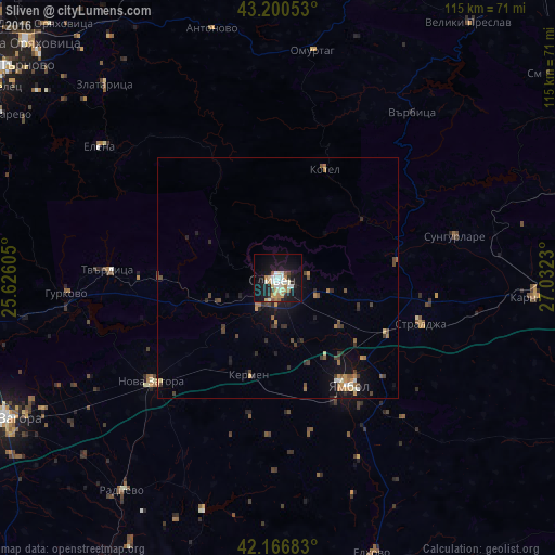
Analysis of Sliven night lights 2016
Square area 10x10 km:
 3.94%
3.94%90-99
7.58%80-89
4.09%70-79
2.42%60-69
3.79%50-59
3.03%40-49
0.91%30-39
1.21%20-29
3.03%10-19
34.39%0-9
35.61%Square area 50x50 km:
0.23%90-99
0.48%80-89
0.27%70-79
0.49%60-69
0.63%50-59
0.38%40-49
0.63%30-39
0.56%20-29
0.65%10-19
2.9%0-9
92.81%Clear (daylight) street map image can be seen on geolist.org.
Map coordinates:
43° 12' 1.9" North, 25° 37' 33.8" East
42° 41' 9" North, 26° 19' 45" East
42° 10' 0.6" North, 27° 1' 56.3" East
Some cities around Sliven sort by population:
• Yambol
26.5 km =16.5 mi,  148°
148°
• Nova Zagora
34.1 km =21.2 mi,  228°
228°
• Karnobat
53.6 km =33.3 mi,  94°
94°
• Omurtag
46.6 km =29 mi,  8°
8°
• Tvarditsa
35.1 km =21.8 mi,  272°
272°
• Kotel
24.1 km =15 mi,  24°
24°
• Elena
45.6 km =28.3 mi,  307°
307°
• Straldzha
30.5 km =19 mi,  108°
108°
727079 (p: 96,368)
Sources (retrieved 2019-11-25):
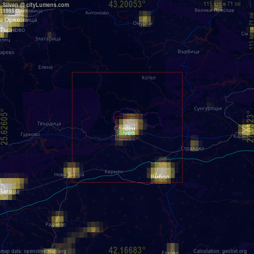
» NASA, Earths city lights 1995
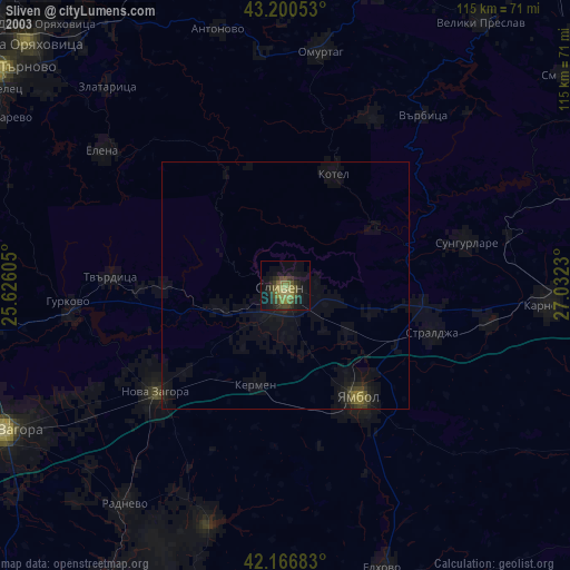
» NASA city lights 2003
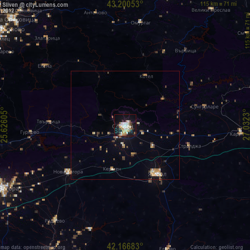
» Earth at Night: Flat Maps 2012, 2016