Kotel night lights from space
Night Light of Kotel (Sliven) from space (Bulgaria) Src. Average luminocity for 10x10km area is 1.1937% and for 50x50km: 1.1292%.
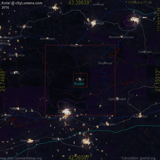
Analysis of Kotel night lights 2016
Square area 10x10 km:
 0%
0%90-99
0%80-89
0%70-79
0.16%60-69
1.11%50-59
0.63%40-49
0%30-39
0%20-29
0%10-19
0%0-9
98.1%Square area 50x50 km:
0.15%90-99
0.3%80-89
0.12%70-79
0.07%60-69
0.15%50-59
0.1%40-49
0.15%30-39
0.02%20-29
0.16%10-19
1.07%0-9
97.72%Clear (daylight) street map image can be seen on geolist.org.
Map coordinates:
43° 23' 47" North, 25° 44' 48.8" East
42° 52' 60" North, 26° 27' 0" East
42° 21' 57.5" North, 27° 9' 11.3" East
Some cities around Kotel sort by population:
• Sliven
24.1 km =15 mi,  204°
204°
• Yambol
44.7 km =27.8 mi,  174°
174°
• Targovishte
42.1 km =26.2 mi,  13°
13°
• Veliki Preslav
43.4 km =27 mi,  43°
43°
• Omurtag
24.2 km =15 mi,  353°
353°
• Tvarditsa
49.3 km =30.6 mi,  245°
245°
• Elena
46.5 km =28.9 mi,  276°
276°
• Straldzha
36.8 km =22.9 mi,  148°
148°
730073 (p: 6,421)
Sources (retrieved 2019-11-25):
» Earth at Night: Flat Maps 2012, 2016