Grez-Doiceau night lights from space
Night Light of Grez-Doiceau (Wallonia) from space (Belgium) Src. Average luminocity for 10x10km area is 14.246% and for 50x50km: 31.5588%.
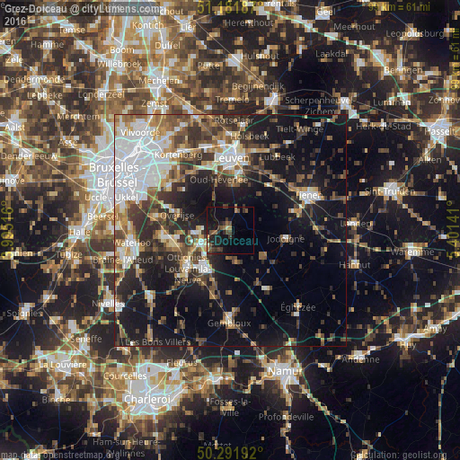
Analysis of Grez-Doiceau night lights 2016
Square area 10x10 km:
 0%
0%90-99
0.4%80-89
0.94%70-79
0.8%60-69
2.27%50-59
2.81%40-49
4.55%30-39
4.95%20-29
4.81%10-19
15.64%0-9
62.83%Square area 50x50 km:
6.91%90-99
4.99%80-89
2.28%70-79
3.24%60-69
4.18%50-59
4.28%40-49
5.54%30-39
6.02%20-29
8.08%10-19
18.64%0-9
35.84%Clear (daylight) street map image can be seen on geolist.org.
Map coordinates:
51° 10' 54.7" North, 3° 59' 42.6" East
50° 44' 20.4" North, 4° 41' 53.8" East
50° 17' 30.9" North, 5° 24' 5.1" East
Some cities around Grez-Doiceau sort by population:
• Wavre
7.2 km =4.5 mi,  250°
250°
• Louvain-la-Neuve
9.8 km =6.1 mi,  216°
216°
• Jodoigne
12.1 km =7.5 mi,  98°
98°
• Chaumont-Gistoux
7 km =4.3 mi,  166°
166°
• Oud-Heverlee
11 km =6.8 mi,  347°
347°
• Huldenberg
9.8 km =6.1 mi,  304°
304°
• Bierbeek
10.9 km =6.8 mi,  23°
23°
• Beauvechain
7 km =4.3 mi,  47°
47°
2797128 (p: 12,367)
Sources (retrieved 2019-11-25):
» Earth at Night: Flat Maps 2012, 2016