Walhain-Saint-Paul night lights from space
Night Light of Walhain-Saint-Paul (Wallonia) from space (Belgium) Src. Average luminocity for 10x10km area is 16.4091% and for 50x50km: 30.4873%.
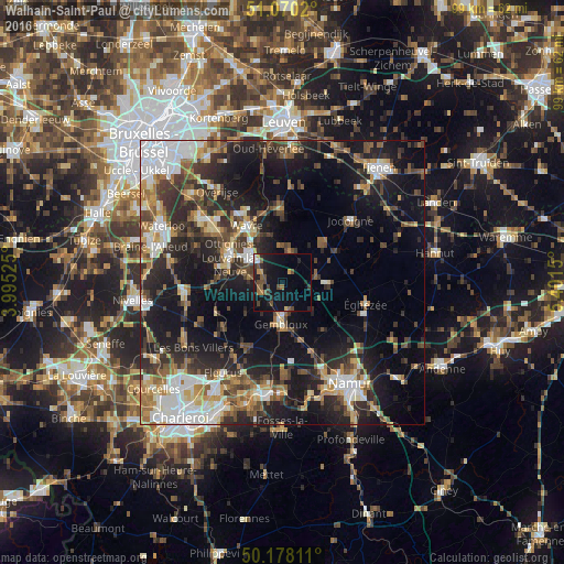
Analysis of Walhain-Saint-Paul night lights 2016
Square area 10x10 km:
 0.8%
0.8%90-99
0.8%80-89
0.53%70-79
2.27%60-69
1.2%50-59
3.48%40-49
5.48%30-39
2.01%20-29
4.81%10-19
22.99%0-9
55.61%Square area 50x50 km:
5.31%90-99
4.92%80-89
2.73%70-79
3.42%60-69
4.28%50-59
4.08%40-49
5.04%30-39
5.53%20-29
9.88%10-19
19.58%0-9
35.23%Clear (daylight) street map image can be seen on geolist.org.
Map coordinates:
51° 4' 12.7" North, 3° 59' 42.9" East
50° 37' 34.6" North, 4° 41' 54.1" East
50° 10' 41.2" North, 5° 24' 5.4" East
Some cities around Walhain-Saint-Paul sort by population:
• Louvain-la-Neuve
7.5 km =4.7 mi,  308°
308°
• Gembloux
7.2 km =4.5 mi,  179°
179°
• Chaumont-Gistoux
5.9 km =3.7 mi,  15°
15°
• Ottignies
10.2 km =6.3 mi,  295°
295°
• Court-Saint-Étienne
9.2 km =5.7 mi,  275°
275°
• Perwez
8.1 km =5 mi,  91°
91°
• Mont-Saint-Guibert
6.3 km =3.9 mi, 278°
• Chastre-Villeroux-Blanmont
4.4 km =2.7 mi,  243°
243°
2784168 (p: 5,992)
Sources (retrieved 2019-11-25):
» Earth at Night: Flat Maps 2012, 2016