Mont-Saint-Guibert night lights from space
Night Light of Mont-Saint-Guibert (Wallonia) from space (Belgium) Src. Average luminocity for 10x10km area is 34.6471% and for 50x50km: 36.5276%.
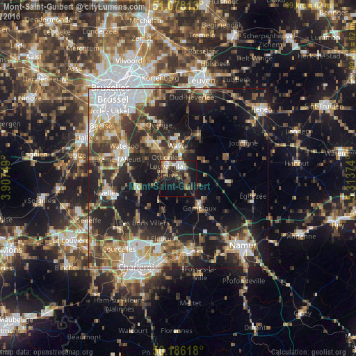
Analysis of Mont-Saint-Guibert night lights 2016
Square area 10x10 km:
 5.88%
5.88%90-99
5.61%80-89
2.67%70-79
2.81%60-69
4.01%50-59
4.28%40-49
8.96%30-39
5.21%20-29
11.23%10-19
34.22%0-9
15.11%Square area 50x50 km:
7.25%90-99
6.05%80-89
3.31%70-79
4.28%60-69
5.28%50-59
5.15%40-49
5.64%30-39
6.63%20-29
11.49%10-19
19.13%0-9
25.79%Clear (daylight) street map image can be seen on geolist.org.
Map coordinates:
51° 4' 41.3" North, 3° 54' 27" East
50° 38' 3.4" North, 4° 36' 38.2" East
50° 11' 10.2" North, 5° 18' 49.5" East
Some cities around Mont-Saint-Guibert sort by population:
• Wavre
9.2 km =5.7 mi,  355°
355°
• Louvain-la-Neuve
3.8 km =2.4 mi,  4°
4°
• Chaumont-Gistoux
9.2 km =5.7 mi,  58°
58°
• Villers-la-Ville
10 km =6.2 mi,  221°
221°
• Ottignies
4.6 km =2.9 mi,  318°
318°
• Court-Saint-Étienne
3 km =1.9 mi,  268°
268°
• Chastre-Villeroux-Blanmont
3.6 km =2.2 mi,  142°
142°
• Walhain-Saint-Paul
6.3 km =3.9 mi,  98°
98°
2790756 (p: 6,557)
Sources (retrieved 2019-11-25):
» Earth at Night: Flat Maps 2012, 2016