Stekene night lights from space
Night Light of Stekene (Flanders) from space (Belgium) Src. Average luminocity for 10x10km area is 25.8908% and for 50x50km: 41.1327%.
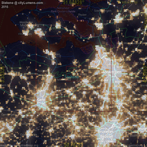
Analysis of Stekene night lights 2016
Square area 10x10 km:
 0.28%
0.28%90-99
1.4%80-89
1.12%70-79
3.08%60-69
4.62%50-59
4.9%40-49
8.82%30-39
6.44%20-29
12.75%10-19
35.29%0-9
21.29%Square area 50x50 km:
8.46%90-99
8.74%80-89
3.89%70-79
4.63%60-69
5.98%50-59
5.81%40-49
7.1%30-39
7.42%20-29
10.28%10-19
10.95%0-9
26.73%Clear (daylight) street map image can be seen on geolist.org.
Map coordinates:
51° 38' 53.8" North, 3° 20' 0.2" East
51° 12' 35.6" North, 4° 2' 11.4" East
50° 46' 2.3" North, 4° 44' 22.7" East
Some cities around Stekene sort by population:
• Sint-Niklaas
9 km =5.6 mi,  123°
123°
• Lokeren
12.2 km =7.6 mi,  194°
194°
• Hamme
14.3 km =8.9 mi,  150°
150°
• Sint-Gillis-Waas
6.2 km =3.9 mi,  80°
80°
• Waasmunster
12.1 km =7.5 mi,  163°
163°
• Axel, NL
10.9 km =6.8 mi,  305°
305°
• Wachtebeke
12.4 km =7.7 mi,  248°
248°
• Moerbeke
8.4 km =5.2 mi,  241°
241°
2786087 (p: 16,989)
Sources (retrieved 2019-11-25):
» Earth at Night: Flat Maps 2012, 2016