Paliseul night lights from space
Night Light of Paliseul (Wallonia) from space (Belgium) Src. Average luminocity for 10x10km area is 0.0028% and for 50x50km: 2.7172%.
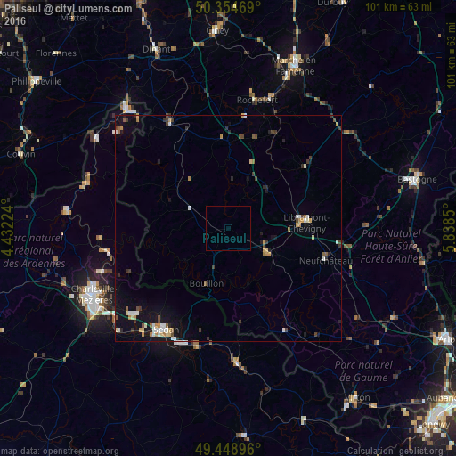
Analysis of Paliseul night lights 2016
Square area 10x10 km:
 0%
0%90-99
0%80-89
0%70-79
0%60-69
0%50-59
0%40-49
0%30-39
0%20-29
0%10-19
0%0-9
100%Square area 50x50 km:
0.29%90-99
0.41%80-89
0.27%70-79
0.27%60-69
0.33%50-59
0.33%40-49
0.34%30-39
0.5%20-29
0.43%10-19
1.9%0-9
94.92%Clear (daylight) street map image can be seen on geolist.org.
Map coordinates:
50° 21' 16.9" North, 4° 25' 56.1" East
49° 54' 14.2" North, 5° 8' 7.3" East
49° 26' 56.3" North, 5° 50' 18.6" East
Some cities around Paliseul sort by population:
• Sedan, FR
26.5 km =16.5 mi,  211°
211°
• Beauraing
26.3 km =16.3 mi,  330°
330°
• Bertrix
10.1 km =6.3 mi,  121°
121°
• Neufchâteau
22.6 km =14 mi,  108°
108°
• Saint-Hubert
21.9 km =13.6 mi,  51°
51°
• Florenville
25.8 km =16 mi,  151°
151°
• Bouillon
13.2 km =8.2 mi,  201°
201°
• Nassogne
29 km =18 mi,  30°
30°
2789354 (p: 5,037)
Sources (retrieved 2019-11-25):
» Earth at Night: Flat Maps 2012, 2016