Seraing night lights from space
Night Light of Seraing (Wallonia) from space (Belgium) Src. Average luminocity for 10x10km area is 63.6684% and for 50x50km: 22.7664%.
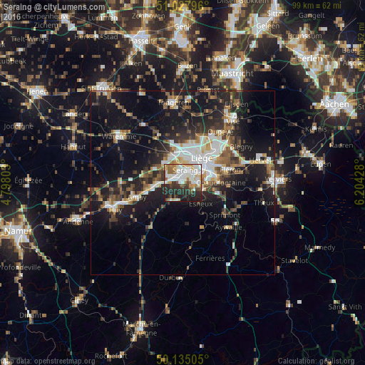
Analysis of Seraing night lights 2016
Square area 10x10 km:
 15.51%
90-99
21.39%80-89
6.15%70-79
5.88%60-69
6.55%50-59
5.35%40-49
4.68%30-39
8.42%20-29
18.05%10-19
8.02%0-9
0%Square area 50x50 km:
3.75%90-99
4.38%80-89
1.81%70-79
2.04%60-69
2.68%50-59
3.37%40-49
3.2%30-39
3.71%20-29
7.57%10-19
17.69%0-9
49.79%Clear (daylight) street map image can be seen on geolist.org.
Map coordinates:
51° 1' 40.7" North, 4° 47' 52.9" East
50° 35' 1" North, 5° 30' 4.1" East
50° 8' 6.2" North, 6° 12' 15.4" East
Some cities around Seraing sort by population:
• Liège
7.3 km =4.5 mi,  40°
40°
• Ans
8.9 km =5.5 mi,  8°
8°
• Flémalle-Haute
4.4 km =2.7 mi,  294°
294°
• Saint-Nicolas
5.4 km =3.4 mi,  23°
23°
• Chaudfontaine
9.4 km =5.8 mi,  90°
90°
• Esneux
7.1 km =4.4 mi,  138°
138°
• Awans
9.7 km =6 mi,  344°
344°
• Engis
7.2 km =4.5 mi,  268°
268°
2786824 (p: 60,737)
Sources (retrieved 2019-11-25):
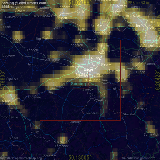
» NASA, Earths city lights 1995
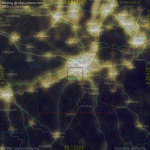
» NASA city lights 2003
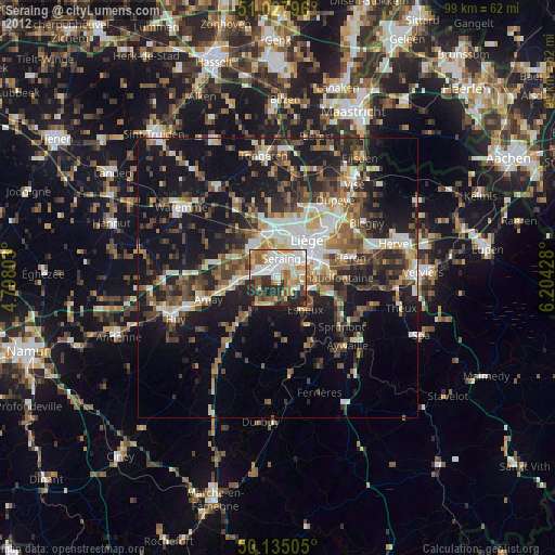
» Earth at Night: Flat Maps 2012, 2016