Kontich night lights from space
Night Light of Kontich (Flanders) from space (Belgium) Src. Average luminocity for 10x10km area is 86.4572% and for 50x50km: 54.0633%.
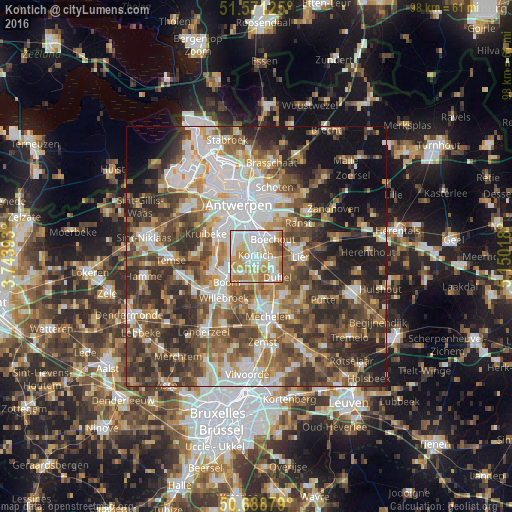
Analysis of Kontich night lights 2016
Square area 10x10 km:
100  27.41%
90-99 24.6%
80-89 14.84%
70-79 17.65%
60-69 11.5%
50-59 2.27%
40-49 1.74%
30-39 0%
20-29 0%
10-19 0%
0-9 0%
27.41%90-99
24.6%80-89
14.84%70-79
17.65%60-69
11.5%50-59
2.27%40-49
1.74%30-39
0%20-29
0%10-19
0%0-9
0%Square area 50x50 km:
100 10.91%
90-99 10.65%
80-89 5.24%
70-79 6.79%
60-69 8.43%
50-59 9.38%
40-49 10.65%
30-39 9.96%
20-29 11.9%
10-19 10.71%
0-9 5.38%
10.91%90-99
10.65%80-89
5.24%70-79
6.79%60-69
8.43%50-59
9.38%40-49
10.65%30-39
9.96%20-29
11.9%10-19
10.71%0-9
5.38%Clear (daylight) street map image can be seen on geolist.org.
Map coordinates:
51° 34' 16.5" North, 3° 44' 38.1" East
51° 7' 55.7" North, 4° 26' 49.4" East
50° 41' 19.6" North, 5° 9' 0.6" East
Some cities around Kontich sort by population:
• Mortsel
3.9 km =2.4 mi,  4°
4°
• Edegem
2.7 km =1.7 mi,  357°
357°
• Duffel
5.9 km =3.7 mi,  133°
133°
• Rumst
5.9 km =3.7 mi,  197°
197°
• Aartselaar
4.2 km =2.6 mi,  273°
273°
• Boechout
4.4 km =2.7 mi,  45°
45°
• Lint
3.5 km =2.2 mi,  99°
99°
• Hove
3 km =1.9 mi,  33°
33°
2794117 (p: 20,290)
Sources (retrieved 2019-11-25):
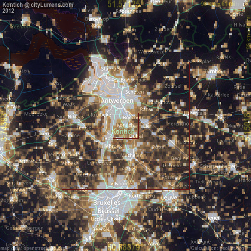
» Earth at Night: Flat Maps 2012, 2016