Kampenhout night lights from space
Night Light of Kampenhout (Flanders) from space (Belgium) Src. Average luminocity for 10x10km area is 62.0462% and for 50x50km: 52.4958%.
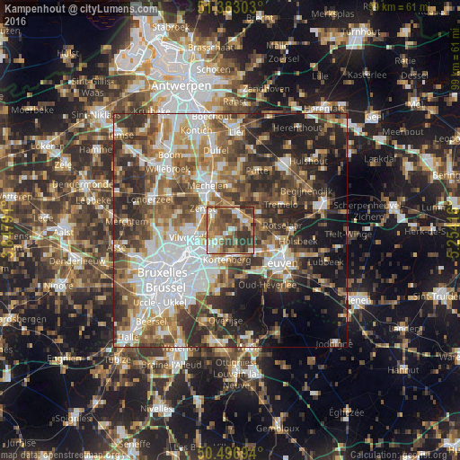
Analysis of Kampenhout night lights 2016
Square area 10x10 km:
 8.68%
8.68%90-99
9.8%80-89
5.32%70-79
9.94%60-69
14.99%50-59
16.95%40-49
15.41%30-39
18.21%20-29
0.7%10-19
0%0-9
0%Square area 50x50 km:
11.95%90-99
9.85%80-89
4.56%70-79
6.16%60-69
8.3%50-59
9.18%40-49
9.3%30-39
9.54%20-29
11.51%10-19
11.56%0-9
8.08%Clear (daylight) street map image can be seen on geolist.org.
Map coordinates:
51° 22' 58.9" North, 3° 50' 52.5" East
50° 56' 31.6" North, 4° 33' 3.7" East
50° 29' 49" North, 5° 15' 15" East
Some cities around Kampenhout sort by population:
• Vilvoorde
8.7 km =5.4 mi,  259°
259°
• Zaventem
8.5 km =5.3 mi,  220°
220°
• Zemst
7.8 km =4.8 mi,  305°
305°
• Kortenberg
5.8 km =3.6 mi,  185°
185°
• Haacht
7.2 km =4.5 mi,  57°
57°
• Machelen
8.4 km =5.2 mi,  245°
245°
• Boortmeerbeek
4.4 km =2.7 mi,  21°
21°
• Steenokkerzeel
3.9 km =2.4 mi,  227°
227°
2794763 (p: 10,784)
Sources (retrieved 2019-11-25):
» Earth at Night: Flat Maps 2012, 2016