Haacht night lights from space
Night Light of Haacht (Flanders) from space (Belgium) Src. Average luminocity for 10x10km area is 48.8025% and for 50x50km: 50.2551%.
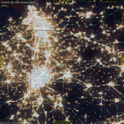
Analysis of Haacht night lights 2016
Square area 10x10 km:
 2.94%
2.94%90-99
2.24%80-89
4.76%70-79
6.44%60-69
9.66%50-59
13.45%40-49
21.57%30-39
23.11%20-29
15.83%10-19
0%0-9
0%Square area 50x50 km:
12.53%90-99
9.44%80-89
4.14%70-79
6.01%60-69
7.54%50-59
8.13%40-49
8.02%30-39
7.7%20-29
9.83%10-19
15.49%0-9
11.17%Clear (daylight) street map image can be seen on geolist.org.
Map coordinates:
51° 25' 4.7" North, 3° 56' 4.7" East
50° 58' 38.5" North, 4° 38' 16" East
50° 31' 57.2" North, 5° 20' 27.2" East
Some cities around Haacht sort by population:
• Herent
8 km =5 mi,  163°
163°
• Putte
8.5 km =5.3 mi,  357°
357°
• Rotselaar
6.2 km =3.9 mi,  116°
116°
• Bonheiden
8.1 km =5 mi,  308°
308°
• Tremelo
5.2 km =3.2 mi,  71°
71°
• Keerbergen
2.9 km =1.8 mi, 355°
• Boortmeerbeek
4.4 km =2.7 mi,  272°
272°
• Kampenhout
7.2 km =4.5 mi,  237°
237°
2796844 (p: 13,541)
Sources (retrieved 2019-11-25):
» Earth at Night: Flat Maps 2012, 2016