Ichtegem night lights from space
Night Light of Ichtegem (Flanders) from space (Belgium) Src. Average luminocity for 10x10km area is 6.0227% and for 50x50km: 23.9559%.
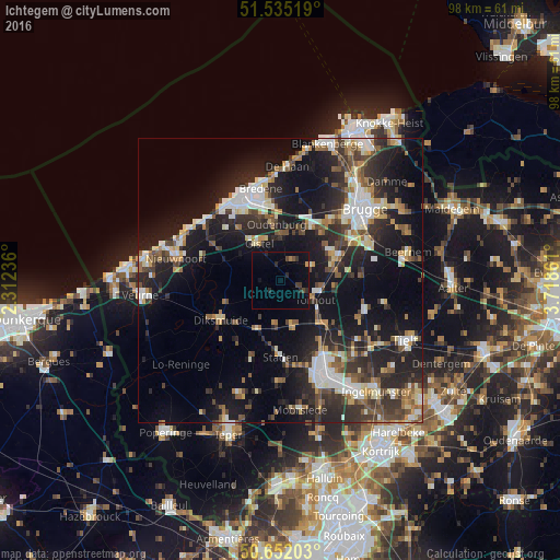
Analysis of Ichtegem night lights 2016
Square area 10x10 km:
 0%
0%90-99
0%80-89
0%70-79
0.53%60-69
0.53%50-59
0.53%40-49
1.47%30-39
1.34%20-29
3.07%10-19
3.21%0-9
89.3%Square area 50x50 km:
3.48%90-99
4.18%80-89
2.42%70-79
2.15%60-69
2.58%50-59
3.28%40-49
3.26%30-39
4.59%20-29
9.32%10-19
19.15%0-9
45.59%Clear (daylight) street map image can be seen on geolist.org.
Map coordinates:
51° 32' 6.7" North, 2° 18' 44.5" East
51° 5' 44.6" North, 3° 0' 55.8" East
50° 39' 7.3" North, 3° 43' 7" East
Some cities around Ichtegem sort by population:
• Zedelgem
9.9 km =6.2 mi,  58°
58°
• Torhout
6.8 km =4.2 mi,  119°
119°
• Jabbeke
10.9 km =6.8 mi,  28°
28°
• Kortemark
7.6 km =4.7 mi,  166°
166°
• Gistel
7.6 km =4.7 mi,  331°
331°
• Oudenburg
10 km =6.2 mi,  353°
353°
• Koekelare
2.7 km =1.7 mi,  257°
257°
• Lichtervelde
11.7 km =7.3 mi,  126°
126°
2795106 (p: 13,582)
Sources (retrieved 2019-11-25):
» Earth at Night: Flat Maps 2012, 2016