Hoeselt night lights from space
Night Light of Hoeselt (Flanders) from space (Belgium) Src. Average luminocity for 10x10km area is 27.2339% and for 50x50km: 35.1344%.
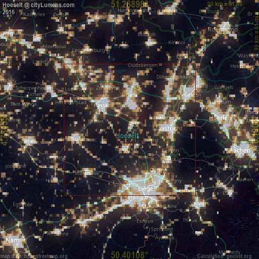
Analysis of Hoeselt night lights 2016
Square area 10x10 km:
 1.82%
1.82%90-99
2.38%80-89
0.84%70-79
0.56%60-69
5.18%50-59
5.6%40-49
4.9%30-39
4.48%20-29
12.46%10-19
59.38%0-9
2.38%Square area 50x50 km:
5.49%90-99
6.21%80-89
2.79%70-79
3.54%60-69
4.92%50-59
4.9%40-49
5.74%30-39
6.79%20-29
13.99%10-19
25.09%0-9
20.54%Clear (daylight) street map image can be seen on geolist.org.
Map coordinates:
51° 17' 20.3" North, 4° 47' 4.4" East
50° 50' 49.7" North, 5° 29' 15.6" East
50° 24' 3.9" North, 6° 11' 26.9" East
Some cities around Hoeselt sort by population:
• Tongeren
7.6 km =4.7 mi,  192°
192°
• Bilzen
3.6 km =2.2 mi,  36°
36°
• Diepenbeek
8.3 km =5.2 mi,  324°
324°
• Riemst
9 km =5.6 mi,  117°
117°
• Borgloon
11.1 km =6.9 mi,  245°
245°
• Kortessem
7 km =4.3 mi,  280°
280°
• Zutendaal
11.4 km =7.1 mi,  32°
32°
• Wellen
10.5 km =6.5 mi,  266°
266°
2795648 (p: 9,265)
Sources (retrieved 2019-11-25):
» Earth at Night: Flat Maps 2012, 2016